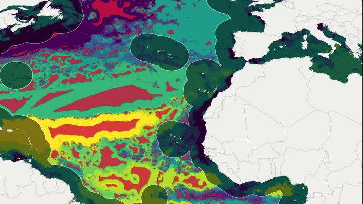
Protecting ocean biodiversity with satellite data
A study, recently published in the Marine Pollution Bulletin, shows that it’s possible to safeguard 30 % of the Atlantic Ocean’s high‑seas biodiversity, without severely disrupting fishing or shipping routes, by harnessing satellite data to define “seascapes” and redirect marine traffic. Using bio‑optical information from ESA’s Envisat, Copernicus Sentinel‑3, alongside NASA’s Aqua, OrbView‑2 and NOAA‑20 satellites, …