
Satellites provide crucial data on crops during COVID-19
Is the pandemic disrupting the growth and harvest of staple crops and the food supply chain? Read the full story.
Is the pandemic disrupting the growth and harvest of staple crops and the food supply chain? Read the full story.
The project will perform an experimental campaign to investigate the potential of Sentinel-2 and PRISMA data to estimate and predict the concentration of different nutrients (K, P, Ca, Fe, Mg, Zn, N and S) in the final agricultural production.
The project aims at improving a current surface albedo generation system by adapting and integrating a deep learning system for cloud detection, an advanced atmospheric correction model which considers the surface BRDF effects, and a new technology allowing to retrieve high-resolution albedo from high-resolution reflectance by combining with downscaled MODIS BRDF climatology
The SenCYF project proposes an innovative crop yield forecasting model based on Sentinel-2 data, validated with a France-wide in situ yield data set. It aims at addressing two core scientific questions: What are the performances of a nation-wide S2-based winter wheat yield estimation model at farm level? What are the performances of a nation-wide S2-based …
The Black Sea is a region of particular interest in terms of its past and present level of ecological degradation by anthropogenic influences among the European Seas and highly dynamic and complex eddy-driven circulation system. The Black Sea receives drainage from almost one-third of the continental Europe (five times its surface area) which, it is …
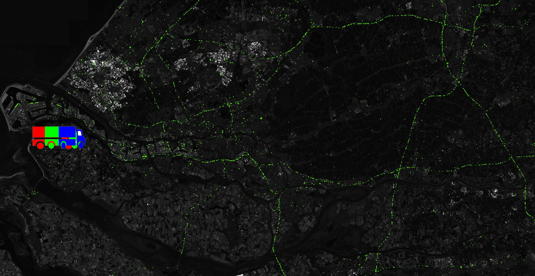
Congratulations to Henrik Fisser, whose Truck detection – Sensing trade from space has been awarded the first prize for the Euro Data Cube COVID-19 edition of the custom script contest. The idea exploits reflectance patterns of long moving vehicles, such as trucks, in Sentinel-2 images. While trucks are essentially too small to be recognised as …
HYDROCOASTAL was a project aimed at maximising the exploitation of SAR and SARIn altimeter measurements in the coastal zone and inland waters, by evaluating and implementing new approaches to process data from CryoSat-2 and Sentinel-3. Optical data from Sentinel-2 MSI and Sentinel-3 OLCI instruments will also be used in generating River Discharge products. New SAR …
Thanks to the work performed within the Sentinel coastal charting worldwide project, the effectiveness of Sentinel-2 data for bathymetry mapping has been proven. Read the full story.
ESA’s Sentinels for Evapotranspiration project, or Sen-ET for short, is exploiting machine learning techniques to combine Sentinel-2 and Sentinel-3 data for a 20m daily evapotranspiration monitoring in agricultural fields. Read the full story.
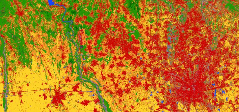
An experimental map of Europe at 10 m resolution displaying 13 land-cover classes can be viewed in full resolution on the CREODIAS EO Browser (select S2GLC and click search), or accessed as a WMS layer for expert use. It has been developed by processing Sentinel-2 data on the cloud with an almost fully automated approach. …