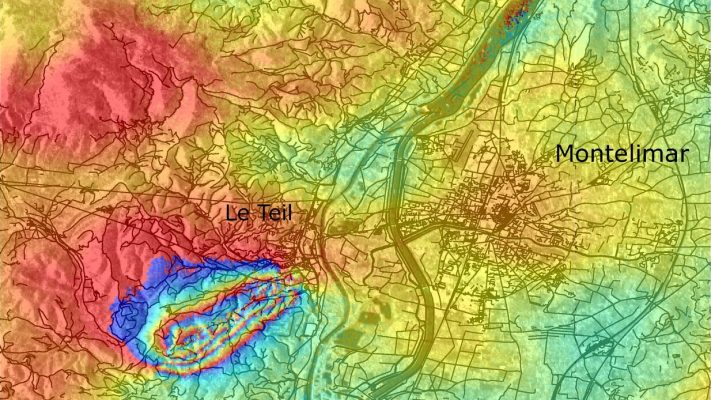
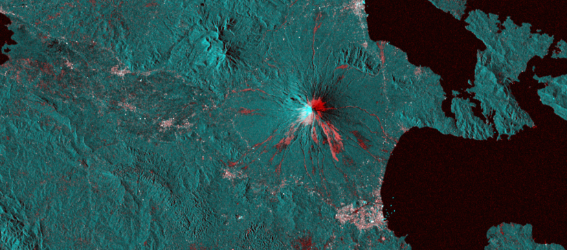
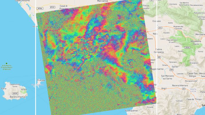
French earthquake fault mapped
Rapid processing and exchange of information within the geohazards community thanks to GEP thematic exploitation platform. Read the full story about the French earthquake case.
Euro Data Cube is a one-stop-shop for browsing, analysis and processing of EO data, from source up to the final product: Access to complete and global EO archives from main all open missions (e.g. Sentinel, Landsat, MODIS, etc.), commercial satellites (PlanetScope, Pleiades, SPOT, WorldView, etc.) as well as Level 3 products (Copernicus Land Monitoring Services, …
The P-TEP provides a complete working environment where users can access algorithms and data remotely, providing computing resources and tools that they might not otherwise have, avoiding the need to download and manage large volumes of data. This new approach removes the need to transfer large Earth Observation data sets around the world, while increasing the analytical power available to …
Water quality and access is essential for socio-economic development and for maintaining healthy ecosystems. Properly managed water resources are a critical component of growth, poverty reduction and equity. The Thematic Exploitation Platform (TEP) for Hydrology is a heterogeneous community of scientific users, river basin organisations and service providers. The aim of this community is to exchange data, …
The G-TEP platform is based upon virtualisation & federation of satellite EO data and methods with the aim to provide innovative responses to the needs of the geohazards community. It provides on-demand and systematic processing services for specific user community needs through advanced services available for both Optical & SAR data, connecting to massive compute power on multi-tenant Cloud Computing resources, to address the challenges …
The TEP Urban platform offers the possibility to define and conduct on-demand processing and production of thematic content based on multi-mission remote sensing imagery (in particular ESA missions including the Sentinel suite and Landsat imagery) and additional data sources (e.g., cadastral data, statistics, socio-economic data). The additional data might either be publicly available on the platform or individually uploaded …
To support future sustainable and efficient farming and aquaculture, the FS-TEP addresses the needs of a heterogeneous user community, spanning from agriculture to aquaculture, from small-scale farmers to agricultural industry, from public science to the finance and insurance sectors, from local and national administration to international agencies. EO data plays a major role in understanding and managing …
C-TEP is a data access service dedicated to improving the efficiently of data-intensive research into our dynamic coastal areas. The C-TEP platform provides advanced tools and data management resources to easily process and manage large volumes of coastal data and make it easily accessible to users. C-TEP is an online service, funded by ESA, which will provide access to over 20 …
The F-TEP serves commercial, governmental and research users in the forestry sector. It enables easy access to satellite data from any global location. The platform offers on-line processing services and tools to generate value-added forest information products. Via the platform, the users can also create and share their own processing services, tools and products. The platform offers pre-processed optical and radar data from …
The amount of data coming from imaging sensors increases steadily and a modern imaging sensor creates frames of several megapixels at a high frame acquisition rate. These imaging sensors with their large data output are mounted on spaceborne platforms, but the downlink capability of these spaceborne platforms, especially for small platforms, has not been increasing …