Fausto Ferraccioli – 3D-Earth project
GOCE gravity images are revolutionising our ability to study the least understood continent on Earth, Antarctica
GOCE gravity images are revolutionising our ability to study the least understood continent on Earth, Antarctica
The combination of seismological and satellite gravity gradient imaging enhance our knowledge of Earth’s structure, especially in remote areas like the Antarctic continent, where even basic knowledge of lithospheric scale features is incomplete. A research team from Kiel University and the British Antarctic Survey exploited the satellite gravity gradients measured from 2009 to 2013 by …
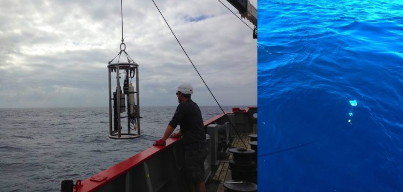
Royal Research Ship James Clark Ross started its roughly 4000 miles, 40 days voyage across the Atlantic Ocean at the end of September. It has been carrying out in situ measurements with an array of instruments including above-water radiometric optical sensors that measure upwelling radiance from the sea surface for validation of satellite ocean colour, …
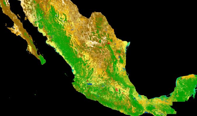
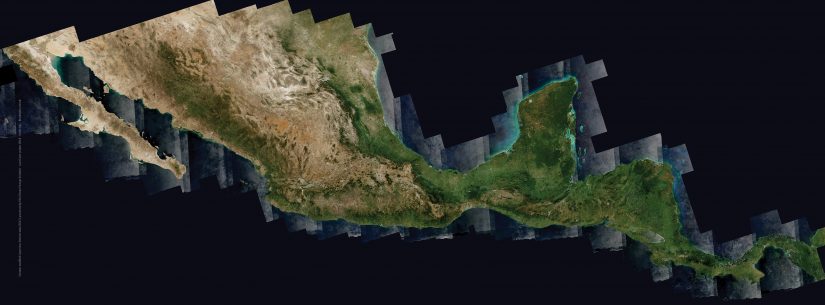
As part of a scientific collaboration with the Mexican Space Agency and other Mexican scientific public entities, ESA has combined images from the Copernicus Sentinel-2 mission to produce a detailed view of the different types of vegetation growing across the entire country. The high-resolution land-cover map combines images captured by Copernicus Sentinel-2 between 2016 and …

Three weeks to go before the start of the Φ-week event to take place at ESRIN, ESA’s Earth Observation centre in Frascati, Italy from 12-16 November 2018. The dense agenda is built around New Space with a special focus on EO. The event brings together emerging space Investors, tech leaders, start-ups and entrepreneurs with the space …
Replay the live-transmitted from the Azores opening session of an event where world-class scientists met to discuss the latest developments in our understanding of Earth’s surface variations observed by altimetry. Radar altimeters record the surface topography along the satellite’s ground track. They precisely measure a satellite’s height above water, land or ice by timing the …
The next Living Planet Symposium (LPS19) will take place in Milan, Italy, on 13–17 May 2019. Abstracts can be now submitted on lps19.esa.int/abstracts until 11 November 2018 (23:59 CEST). Navigate through the session list and descriptions and carefully check out guidelines for submitting an abstract.
A full week is just over of training on the theory and applications of land remote sensing, ranging from the theoretical fundamentals and advanced concepts of spaceborne optical, thermal and microwave remote sensing to hands on use of software tools for a variety of applications including urban mapping, change detection, fire detection, forestry, vegetation monitoring, …

Over the last decade, rapid developments in digital technologies and in our capability to monitor our home planet from space with Earth Observation (EO) satellites have led to new and huge opportunities for science and businesses. There is an increasing need to mine the large amount of data generated by the new generation of satellites …
The annual global CCI land-cover maps at 300m resolution, spanning a 24-year period, from 1992 to 2015, have been used to develop the new OECD Green Growth headline indicator on land-cover change. More recently, the same CCI land-cover team has also demonstrated the performance of the Copernicus Sentinel-2 mission to deliver 10 m resolution land-cover …