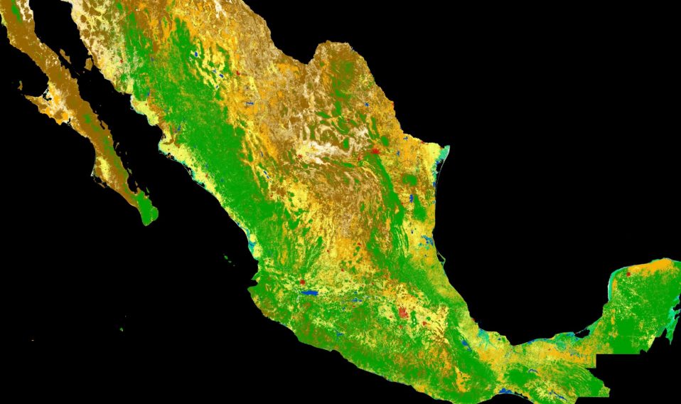
As part of a scientific collaboration with the Mexican Space Agency and other Mexican scientific public entities, ESA has combined images from the Copernicus Sentinel-2 mission to produce a detailed view of the different types of vegetation growing across the entire country.
The high-resolution land-cover map combines images captured by Copernicus Sentinel-2 between 2016 and 2018.
Read the full story.