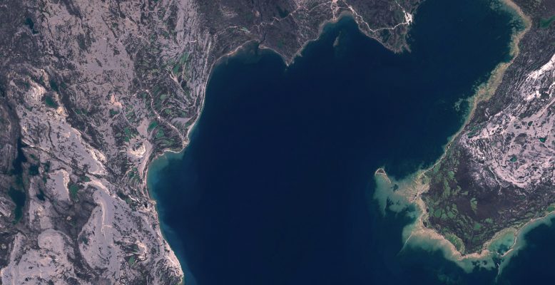
Enhanced Satellite Derived Bathymetry (SDB) with Sentinel-2
Thanks to the work performed within the Sentinel coastal charting worldwide project, the effectiveness of Sentinel-2 data for bathymetry mapping has been proven. Read the full story.
Volcanic monItoring using SenTinel sensors by an integrated Approach (VISTA) project is aimed at developing a novel ensemble of algorithms to completely characterized the effects of volcanic emissions on land and atmosphere. Volcanic activity is observed worldwide with a variety of remote sensing instruments, each one with advantages and drawbacks. Because a single remote sensing …
The ocean carbon cycle is a vital part of the global carbon cycle. It has been estimated that around a quarter of anthropogenically-produced emissions of CO2, caused from the burning of fossil fuels and land use change, have been absorbed by the ocean. On the other hand, significant advances have been made recently to expand …
CYMS is an ESA-funded project aiming at scaling up an operational service for Tropical Cyclone (TC) monitoring, in view of its potential integration as part of a Copernicus Service. The main scientific and technical objectives are to: Develop a sustainable acquisition strategy dedicated to TC ; Consolidate S-1 end-to-end processing chains for ocean surface wind …
SatHound is a solution to allow non-technical users configuring and executing multi-object detection processes over satellite images, based on deep learning technologies providing the following features: Two modes of operation in a clean and powerful user interface with Web-GIS capabilities: The training mode is used for teaching the system how to recognize new objects or …
The movie above is demonstrating how the QuantEO service may be used to detect water over time in Sub Saharan Africa from Senegal to Ethiopia. This is a sample application of the service, developed by Pixstart within an Open Call project, which allows to produce classified Sentinel-2 images on demand and near real time …
SUMO4Rail aims at a concise evaluation of the German ground motion service (Boden-Bewegungs Dienst – BBD) deformation products with dedicated consideration of the requirements of the Eisenbahn-Bundesamt (German Federal Railway Authority, Germany – EBA) including the valorization of these deformation products for the EBAs monitoring and decision support system. This include: Performing post-processing of BBD …