Tags: marine environment, coastal zone
Sentinel coastal charting worldwide
Prime company: ARGANS LIMITED (GB)The advent, with Sentinel-2, of a satellite constellation offering High Resolution (HR), high revisit time and free images has raised encouraging hopes amongst Coastal States and the Maritime community of Users who, in 2018, still suffer from the persistence of inaccurate nautical charts. These expectations however did not materialise because the Government agencies in charge …
Pioneer new EO applications: tipping and cueing for maritime surveillance service
Prime company: DEIMOS IMAGING S.L.U. (ES)One of the advantages of constellations of EO satellites is the capability to observe areas or features of interest more often than a conventional satellite would allow. However this usually requires rapid tasking of follow-on satellites based on information collected from a lead satellite. This “Tipping and cueing” is critical to ensuring an effective monitoring …
TEMITH – Total Ecosystem Management of the InterTidal Habitat
Prime company: DEIMOS SPACE UK LTD (GB)Intertidal habitats are highly productive areas; they provide bird habitat and feeding areas, commercial fish nursery grounds as well as the ecosystem services of nutrient cycling and coastal protection. Globally, these habitats are in decline due to overexploitation, direct damage and numerous other stressors. Achieving total ecosystem management (TEM) to support conservation and sustainable exploitation …
BALTIC+ SEAL – Sea Level
Prime company: TECHNICAL UNIVERSITY OF MUNICH (DE)The current knowledge of the water circulation in the Baltic Sea comes essentially from in situ observations and models. The Baltic+ SEAL (Sea Level) Project aims at providing a consistent description of the sea level variability in the Baltic Sea area in terms of seasonal and inter-annual variation and put the results in relationship with …
European coastal erosion under the spotlight
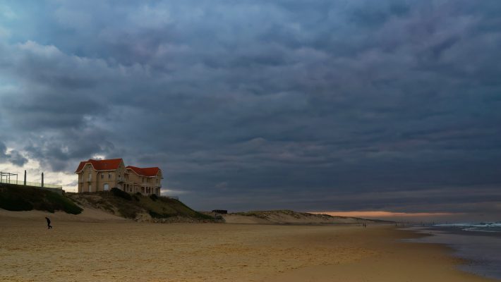
During the last few years, the Nouvelle-Aquitaine coast has been repeatedly hit by severe storms causing coastline retreat of several meters (from 10 to 40 meters in 2013-2014, from 5 to 13 meters in 2018). Modelled sea-level rise impact on the same coastline is projected to cause (see the Néo Terra 2019 and the AcclimaTerra …
Sargassum monitoring service
Prime company: CLS COLLECTE LOCALISATION SATELLITES (FR)The project objective is to develop and implement an innovative automated service based on Earth Observation (EO) data to monitor floating Sargassum algae in the Caribbean area, estimate their drift and eventual landings on the coasts, and provide dedicated bulletins to the end-users.
Monitoring sargassum drift with Sentinel-3 and MODIS
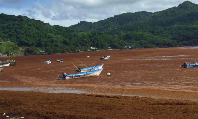
Since 2011, sargassum rafts of unprecedented size have had been found on Caribbean shores, with a strong impact on tourism, fisheries and wildlife. As sargassum decomposes on beaches, it releases disagreeable odours. Removal is time-consuming and expensive as mats can be several meters thick. Tourists are bothered by sargassum, and incoming rafts smother sea grasses …
Remote Sensing of Environment special issue
The Science and Applications with Sentinel-2 special issue of Remote Sensing of Environment has been completed with the last paper published on 5 April 2019. It features a selection of 28 key papers covering a wide range of new applications monitoring natural and human-induced dynamic processes up to national and even continental scale at high-resolution. …
BathySent – An Innovative Method to Retrieve Global Coastal Bathymetry from Sentinel-2
Prime company: BUREAU DE RECHERCHES GEOLOGIQUES ET MINIERES (BRGM) (FR)The BathySent project aims at the development of an automated method for mapping coastal bathymetry (water depths) on the basis of Copernicus Sentinel-2 mission. The interest of using Sentinel-2 data lies on the capacity to cover large areas (National and European scale targeted), while benefiting from the high repeat cycle (5 days) of the mission. …