JupyterGIS breaks through to the next level
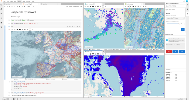
Launched in June 2024, JupyterGIS was introduced as a collaborative, web-based GIS environment built on the JupyterLab framework. Its objective is to bring QGIS-inspired workflows into the browser, enabling real-time collaborative editing, seamless integration with notebooks, and support for core geospatial data formats. When it was first announced earlier this year, JupyterGIS already delivered: Real-time …