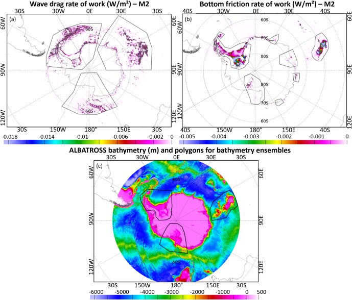
A recently published paper, titled ALBATROSS: Advancing Southern Ocean Tide Modelling with High Resolution and Enhanced Bathymetry, introduces an advanced tidal model specifically tailored to the unique dynamics of the Southern Ocean and Antarctic regions. This research is the outcome of the ALBATROSS project, and combines high-resolution bathymetry data from the reprocessing of a decade-long CryoSat-2 mission data with improved modelling techniques to address challenges in tidal predictions below the 66°S latitude, where conventional satellite altimetry measurements are limited.
The ALBATROSS model leverages satellite altimetry and data assimilation methods to fill crucial gaps left by traditional tide models, particularly in areas impacted by complex ice-shelf interactions. By incorporating detailed bathymetric data, ice draft measurements, and coastal datasets, the model can provide more accurate simulations of tidal heights and currents. These improvements are essential for understanding ocean circulation, ice-shelf melt rates, and broader climate dynamics in polar regions.
Comparisons with existing tide gauge data and GPS stations reveal that the ALBATROSS model achieves significantly higher accuracy, reducing root mean square errors in key regions by nearly 40%. This breakthrough will enhance satellite-based sea-level measurements, offering precise tidal corrections for new missions like SWOT, Sentinel-3 NG and CRISTAL.

Eva Le Merle, Carole Belot, Ergane Fouchet, Mathilde Cancet, Ole Baltazar Andersen, Florent Lyard, Geir Moholdt, Michel Tsamados, Mahmoud El Hajj, Josephine Maton, Jérôme Benveniste, Marco Restano, ALBATROSS: Advancing Southern Ocean tide modelling with high resolution and enhanced bathymetry, Polar Science, 2024, 101124, ISSN 1873-9652, https://doi.org/10.1016/j.polar.2024.101124.
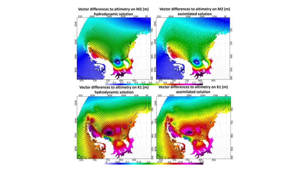
Featured image : Maps of vector differences between the model and the altimetry data on M2 tide (top panels) and MK1 tide (bottom panels) in the Weddell Sea for the hydrodynamic (left side) and assimilated (right side) solutions. The white circles represent the assimilated points. Black circles represent the vector differences. The size of the circle indicates the error on the amplitude with scale shown in the bottom left corner from smallest to largest: 5e-3 m, 1e-2 m, 2e-2 m, 5e-2 m, 1e-1 m.

