In mountainous regions such as the Alps, snow cover plays a crucial role in the hydrological cycle. Precipitation in these areas in winter, particularly above 1,000 metres altitude, remains stored as a snowpack until the spring melt season, when water is released back into rivers and reservoirs. This seasonal water reserve is critical for water availability during spring and summer, impacting our society and the environment. Timely and accurate monitoring of snow cover, depth, and melt patterns is essential for anticipating seasonal water reserves, preparing for droughts, and managing water resources effectively.
With advanced snow monitoring systems, organisations can better understand the relationship between snowpack conditions and downstream effects, adjusting their water management strategies, reducing risks associated with flooding or drought and optimising water use in agriculture, industry, and energy production.
Improving hydrological forecasting with the Digital Twin Alps
The Digital Twin Alps project, part of the Alps Regional Initiative activities, has a dedicated focus on the unique environmental and societal dynamics of the Alpine region.
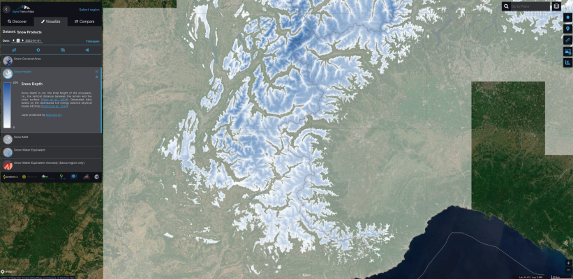
The snow processing chain is its core system, which generates various information products to monitor snow cover dynamics in the Alps region and makes them available in a free access demonstrator. The snow service collects and processes meteorological data, such as precipitation, temperature, and solar radiation, using ERA5 reanalysis data to reliably simulate snowfall events and snowpack melting conditions. This data feeds into a physical model, GEOtop, which reconstructs snowpack evolution by incorporating both modelled snow parameters and satellite-derived Snow Covered Area maps, generated through advanced algorithms. This integration enhances model accuracy by correcting any discrepancies, offering a robust analysis of snowpack dynamics.

Historically, snow modelling in the Alps has been limited by a scarcity of models that can operate daily at mid-resolution, balancing a broad synoptic view with the detail needed for basin-level applications. Responding to this need, the initial snow model, developed within the EO4ALPS-snow project, assimilated composite snow cover maps from Sentinel-1, 2, and 3 satellites.
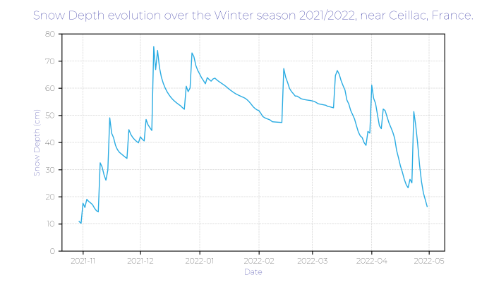
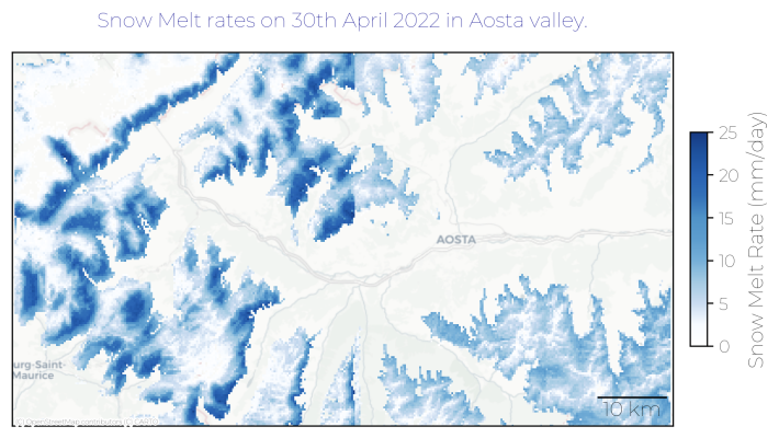
This model was further developed and refined in the scope of the Digital Twin Alps project and became a service which now provides essential now-casting products at 250m resolution across the Alps on a daily basis, including Snow Water Equivalent, snow depth, and snowmelt. Weekly snow-covered area maps over the Alps, and three-day snowmelt forecasts are also generated over the Alps.
Additionally, the system supports a demonstration focused modelling in the Sarca river basin, generating daily temperature and precipitation maps, and bi-monthly Snow Water Equivalent anomaly maps for trend analysis.

Use cases of the Snow Cover service
The snow processing chain provides essential tools for stakeholders whose operations depend on precise, real-time information about snow and water resources. For example, hydropower and municipal sectors require timely information about the water quantities stored in the snowpack, as it directly influences operational planning and resource management. These users can leverage the Snow Water Equivalent data from the Digital Twin Alps, to do daily operational monitoring and forecasting, but also estimate seasonal water volume trends, enabling them to adjust strategies in anticipation of water surpluses or shortages. To this end, members of the Digital Twin Alps project are collaborating closely with a stakeholder in Austria who will apply the snow service chain outputs to enhance hydrological modelling in Tyrol. This initiative, supported under the Digital Twin of Austria project funded by the Austrian Research Promotion Agency (FFG), underscores the practical application of Digital Twin Alps’ snow processing tools to refine water management and resource planning at a regional scale in Austria.
Beyond resource management, the snow processing chain also benefits research centres focused on climate and environmental studies. The data generated from Digital Twin Alps’ snow processing chain can be directly integrated into existing models and workflows using the platform’s APIs, offering additional input data over the last 7 years.
Additionally, the tourism industry, which relies on up-to-date information about snow cover for planning winter recreational activities, can leverage the Digital Twin Alps’ insights to better understand and predict snow distribution across alpine locations.

Access the Digital Twin Alps free products
The development of the Digital Twin of Alps demonstrator has now concluded, and the platform is freely available to the public here.
A roadmap outlining the implementation of future Digital Twin Earth instances, incorporating valuable feedback gathered throughout the demonstration phase, has been created and will be published shortly. Moving forward, the focus will be on working closely with interested stakeholders to help them understand and integrate Digital Twin capabilities into their operational workflows. This collaborative approach aims to ensure the long-term sustainability and practical application of Digital Twins in decision making in the Alpine regions.
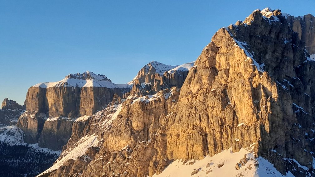
Featured image : Photo credit: Maxim Lamare

