Ice velocity is an essential parameter to study ice sheet and glacier dynamics. It is needed to estimate the mass flux and discharge of ice from the accumulation zone to the ocean and hence influences estimates of ice sheet mass balance and sea level rise. Furthermore, ice velocity measurements constitute valuable input for constraining and validating numerical ice sheet models seeking to infer, for example, basal sliding patterns and ice thickness.
The operational strategy of the Sentinel-1 SAR satellite constellation in monitoring the polar regions is providing new insights into the ice dynamics of ice sheets and ice caps by creating an unprecedented archive of regularly acquired free and open access data. However, concerning ice velocity, such an archive is not yet being exploited to its full potential.
Exploiting Sentinel-1 SAR phase information for ice velocity retrieval
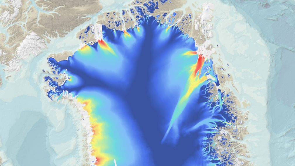
Current processing systems exploit Offset-Tracking to retrieve ice velocity fields using 6- to 12-day Sentinel-1 repeat pass observations. Offset-Tracking can be successfully applied on fast-moving outlet glaciers at the margins of the Greenland and Antarctic ice sheets. However, the sensitivity of this technique is limited to observe the details of ice dynamics in the slow-moving interior regions. In these regions differential SAR interferometry (DInSAR) is more favourable to monitor ice velocity with a high level of detail and accuracy. Within the PHAB-IV project, awarded to DTU Space, ENVEO and GEUS via the Permanently Open Call, the technical challenges of Sentinel-1 TOPS Mode data for ice velocity retrieval using DInSAR, including phase discontinuities at burst overlaps caused by moving ice have been solved. The developed algorithm leads to a more detailed ice velocity field compared to the currently operationally used Offset-Tracking technique particularly in slow moving areas, as shown in Figure 1.
Sentinel-1 Interferometric Wide swath (IW) SAR imagery acquired on the Greenland Ice Sheet between 16 December 2019 and 25 January 2020 was processed by the Technical University of Denmark (DTU Space) to generate an ice velocity mosaic with a spatial resolution of 50m x 50m and with (1-sigma) horizontal velocity accuracies in the interior of the ice sheet of 0.18 m/y and 0.44 m/y in the x and y components, respectively, as compared to GPS. These values represent a 5-fold improvement in both resolution and accuracy, compared to current state-of-the-art Sentinel-1 ice velocity products, which are based on Offset-Tracking methods and rely exclusively on SAR image amplitude.
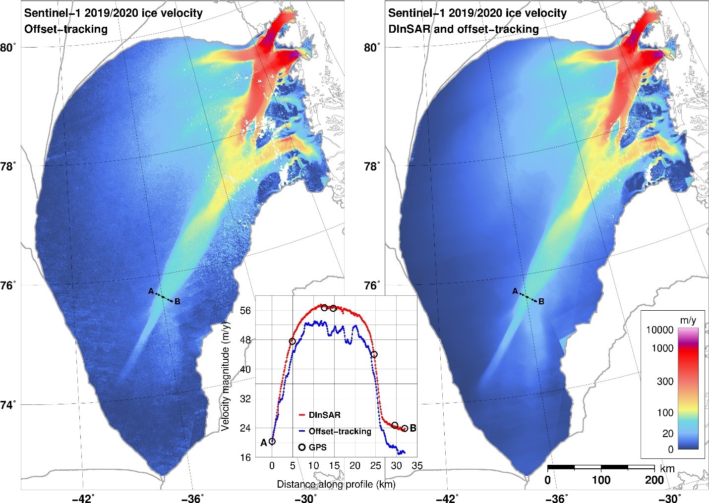
The developed DInSAR approach has been successfully applied by ENVEO on an ice sheet wide scale, as demonstrated for Greenland using Sentinel-1 data from 2017 to 2020 (Figure 2). The high sensitivity of DINSAR allows to identify the response of marginal acceleration and thinning on the ice flow in the slow-moving interior of Greenland and can even reveal information on basal hydraulics.

Towards operational products
Although further R&D work is still needed for fully automated processing and product generation, the synergy of DInSAR and Offset-Tracking will lead to next generation ice velocity products with enhanced spatial resolution and accuracy. Within the ESA Greenland Ice sheet CCI+ project, the first ice velocity products based on both DInSAR and Offset-Tracking have been released and the first Sentinel-1 Greenland Ice Sheet wide product was generated.
Ruth Mottram, Climate Scientist at the Danish Meteorological Institute, says:
“Ice velocity is important to us in being able to monitor the health of the Greenland ice sheet in near real-time. By measuring the speed and quantity of ice flowing out of the outlet glaciers into the ocean, we can get a good estimate of how much ice is lost by calving and submarine melting. Thanks to high resolution numerical weather prediction we can present this in near real time on the polar portal. Being able to add data from a project like PHAB-IV would be a huge step forward for real time monitoring.“