
- This event has passed.
EOAFRICA Webinar: Hyper-Temporal Mapping of Agro-Ecological Systems
August 25, 2022 @ 14:00 - 15:30 UTC+2
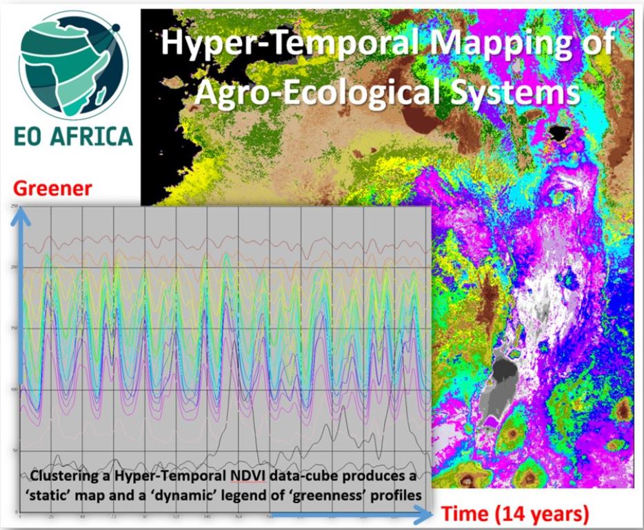
This webinar introduces participants with the necessary theoretical and practical knowledge to map agro-ecological systems at region to country levels (benchmark mapping) for subsequent monitoring using ‘future’ EO-derived imagery. ‘Past’ hyper-temporal (HT) time-space NDVI-based data-cubes will be studied to create an agro-environmental stratification that relates to land features like terrain, climate, land cover (green vegetation) and land use (practiced crop calendars). The data-cube also represents (seasonal) impacts of weather differences on vegetation performance and also gradual and abrupt changes in land use and land cover. Acquisition and pre-processing of the HT-vegetation (NDVI) data sets, and its visualization, interpretation and analysis will be discussed.
The duration of the webinar is 1.5 hours. During the webinar there is a live-chat available.