A study, recently published in the Marine Pollution Bulletin, shows that it’s possible to safeguard 30 % of the Atlantic Ocean’s high‑seas biodiversity, without severely disrupting fishing or shipping routes, by harnessing satellite data to define “seascapes” and redirect marine traffic.
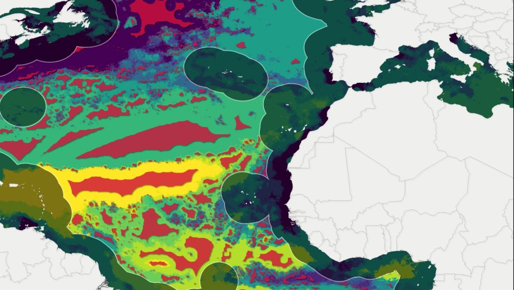
Using bio‑optical information from ESA’s Envisat, Copernicus Sentinel‑3, alongside NASA’s Aqua, OrbView‑2 and NOAA‑20 satellites, the team from the Biodiversity in the Open Ocean: Mapping, Monitoring and Modelling (BOOMS) project delineated areas of similar biological and physical characteristics (“seascapes”). They then overlaid Automatic Identification System (AIS) data to map existing shipping and fishing lanes, demonstrating that protective zones around each seascape’s centroid could meet the UN’s 30 × 30 biodiversity target while shifting, rather than blocking, human activities.
Read the full story on ESA EO pages.