About cultural and natural heritage and EO: let us hear your voice at LPS22

The pandemic stroke particularly hard on cultural heritage, with the collapse in tourism revenues, increased vulnerability of sites to looting, suspension of rehabilitation, conservation and archaeological exploration works. Geo-hazards, extreme events and expected climate change consequences are pending threats to be taken into account.

This led organisations to rethinking their models for protecting heritage sites in the future.

A number of studies have already demonstrated a variety of potential uses of data from satellites when looking at cultural heritage. Sentinels and Copernicus contributing missions, in combination with cutting edge technologies such as artificial intelligence (AI) and machine learning (ML) are paving the way for an ever increasing role of EO in the sector.

Hence cultural and natural heritage will be one of the themes on stage at next year’s Living Planet Symposium, one of the largest events worldwide dedicated to Earth observation.

You are invited to submit an abstract (deadline 26 November 2021) to gain the opportunity to be a speaker in the dedicated session at the symposium.

The session aspires to provide a forum to discuss how satellite data and infrastructure are enablers for technological innovation and tailored solutions to address specific user needs.

Find here below the summary description of the dedicated scientific session to address:

D2.12 Cultural and Natural Heritage

Cultural and Natural Heritage (CNH) has a major significance for local communities, and symbolizes the legacy and resources that will be passed on to future generations. CNH has therefore a critical value in building the local identity and strengthening the regional growth and development, and is included in the United Nations’ 2030 Agenda for Sustainable Development.

There is a wide consensus about the usefulness of satellite technologies to support the study, documentation and systematic monitoring for protection and sustainable maintenance of CNH. This emerged quite explicitly at the exchange among experts during the last LPS19 in Milan. The session Sentinels and Copernicus Contributing Missions for Cultural & Natural Heritage attracted a wide representation of academic and industrial remote sensing science community who showcased how the Sentinels and Copernicus contributing missions are effective in providing an objective source of geospatial information to undertake a variety of specific tasks, such as: risk assessment, archaeological prospection, landscape archaeology, land use land cover mapping, evaluation of climate change impacts. Moreover, the delegates attending the session included also members from public administrations and authorities in charge of CNH management that were interested in learning how latest technological developments can generate a concrete impact on their domain of work.

Since then, the sector has further developed. The Copernicus Cultural Heritage Task Force (2020) has highlighted how the majority of the current Copernicus products satisfy the identified user requirements, and envisioned the high potential for Copernicus to stimulate substantial growth of the Cultural Heritage downstream market. For example, CEMS and SECURITY service have already dedicated sections for Cultural Heritage monitoring, while the community is looking forward to the potential benefits that will be provided by some specific products of the Copernicus Climate Change Service (C3S). Furthermore, various initiatives have been launched by ESA (e.g. Downstream Gateway, ARTES IAP) and national space agencies to support the development of downstream applications in the CNH sector.

In this context, this session aims to understand how EO scientists, CNH user community and institutional bodies have further progressed in the scientific exploitation of satellite data, also in combination with cutting edge technologies such as artificial intelligence (AI) and machine learning (ML) to provide further benefits to professionals involved in the field of CNH but also to larger interested public, education and research sector.

The session aspires to provide a forum to discuss how satellite data and infrastructure are enablers for technological innovation and tailored solutions to address specific user needs.

We therefore encourage submissions focusing on:

  • Solutions based on the exploitation of the Sentinels, Copernicus contributing missions and/or Third Party Missions data, as well as exploitation of AI, ML, thematic platforms, cloud computing resources and infrastructure, collaborative environments;
  • Benefits from the use of Copernicus products and services, also in relation to impacts due to climate change and towards future resilience in CHN management;
  • Use cases addressing specific user requirements and needs in the field of either CNH discovery, study, monitoring, preservation or cultural/touristic promotion;
  • Practical examples of EO integration in operational systems, workflows and processes on CNH;
  • Downstream applications, with a focus on multidisciplinary collaboration and partnerships between heritage institutions, academia and commercial providers;
  • Initiatives of capacity building towards user uptake by the CNH community and end-users.

Convenors: Deodato Tapete (Agenzia Spaziale Italiana, ASI), Francesca Cigna (CNR-ISAC), Branka Cuca (Politecnico di Milano), Iulia Dana Negula (Romanian Space Agency – ROSA), Cristian Moise (ROSA), Jolanda Patruno (RHEA System S.p.A)


The Living Planet Symposia bring together scientists and researchers from all over the world to present and discuss the latest findings on Earth science and advances in Earth observation technologies. Moreover, these extraordinary events also offer unique forums for decision-makers to be better equipped with information, for partnerships to be forged and formalised, for space industries to join the conversation, for students to learn, and for all to explore the concepts of New Space such as the digital transformation and commercialisation.


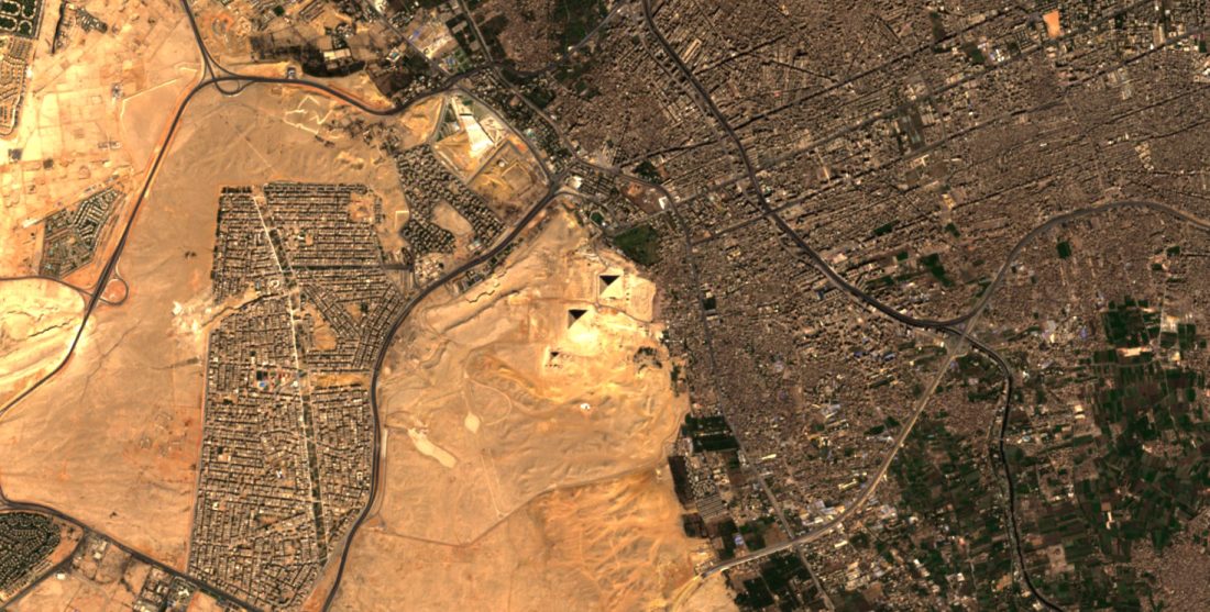
Featured image : Giza Pyramid complex, Egypt. Contains modified Copernicus Sentinel data (2021), processed by ESA, CC BY-SA 3.0 IGO

SHARE