Methane continues to increase in our atmosphere, and now researchers want to quantify the role of high Northern latitudes to this increase. Earth-observing satellites open the window to this remote, rapidly changing environment.
Carbon cycle in the Arctic and boreal regions links strongly to the evolving cryosphere – ice, snow and frost. Especially natural methane emissions from wetlands are controlled by seasonal frost and thaw of the soil. In the ESA Science for Society project MethEO, researchers from the Finnish Meteorological Institute (FMI) aim to quantify the connection. Tuula Aalto, project co-PI, highlights the scientific focus: “We know from FMI field measurements in Sodankylä and Pallas that seasonally freezing soil affects natural methane emissions. In MethEO project, we will look at a larger scale by combining satellite data and atmospheric inversion modeling.”

Growing fleet of Earth-observing satellites provide measurements of atmospheric composition but also a number of measurements on changes in the cryosphere. FMI has recently developed a novel, publicly available satellite data product indicating soil freeze and thaw based on ESA’s Soil Moisture and Ocean Salinity (SMOS) mission. “When the liquid water in the soil freezes, the emitted thermal radiation from the soil changes notably, contrasting the signal from thaw soil. We can detect this particularly well from the SMOS L-band microwave observations that provide information from deeper layers of the soil, up to about 10–15 cm,” describes Kimmo Rautiainen, project PI and the developer of the product at FMI. “SMOS celebrates its 10-year anniversary in space this year. With our new freeze/thaw product, we can see large variability in the soil state during the past 10 years especially at high latitudes.”

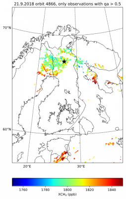
In MethEO project, SMOS satellite data are used together with space-based measurements of atmospheric methane. ESA’s Sentinel 5P TROPOMI has revolutionized methane observations with the unprecedented daily global coverage combined with a good spatial resolution. “With TROPOMI, we have now manifold methane observations over Northern Finland”, says project scientist Ella Kivimäki, excitedly. Japanese Greenhouse Gases Observing Satellite GOSAT, an ESA third-party mission, has been observing methane for ten years. “GOSAT is important for evaluating longer-term trends in atmospheric methane, but we expect TROPOMI to be extremely useful for methane emission estimates,” Kivimäki continues.
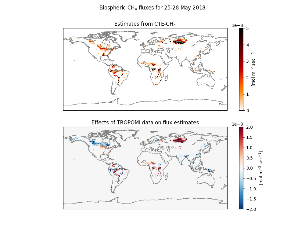
Methane is a long-lived greenhouse gas and is transported with winds further from the origin of its source locations. Therefore, local atmospheric methane observations contain information more than just local emissions. Atmospheric inverse model is an effective tool for solving the emissions in large regions, where information from the observations are used. Project scientist Aki Tsuruta explains that the model developed at FMI – CarbonTracker Europe CTE-CH4 – uses unique measurements in the model. “We traditionally only use atmospheric observations in the model. In MethEO project, we update the tradition by using newly manifolded atmospheric methane observations from GOSAT and S5P satellites. In addition, we combine information from SMOS soil freezing data in the estimation of methane emissions for the first time”, Tsuruta specifies. “We expect this to improve methane emission estimates for wetlands, especially at seasonally freezing regions at high Northern latitudes.”

ESA MethEO project started in the 2018 fall and is expected to finish by early 2020. The project and its first results are presented in several conferences, e.g., ESA Living Planet Symposium in spring 2019, European Geosciences Union 2019 meeting, and Joint Satellite Conference in fall 2019.
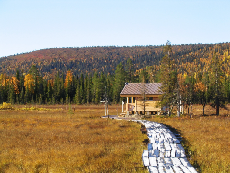
Featured image : Lompolojänkkä peatland in Northern Finland. Photo credit: Tuula Aalto, FMI
Article by Hannakaisa Lindqvist, FMI

