Interferometric (InSAR) short-time-series of Sentinel-1 SAR data acquired over central Europe were exploited in a new approach for the generation of large-scale thematic maps. Temporal features, extracted from the evolution of the interferometric coherence, together with backscatter, were used as input for a machine learning-based classifier. Three land cover classes were extracted: artificial surfaces, forests, and non-forested areas, with an overall classification accuracy above 90%.
The approach confirms the importance of repeat-pass SAR interferometry for land cover classification and shows high potentials for assessing abrupt land cover changes. The paper further promotes the added-value of Sentinel-1 short revisit time for the development of a nearly-real time deforestation monitoring approach.
Full results of the study can be found in: F. Sica, A. Pulella, M. Nannini, M. Pinheiro, P. Rizzoli (2019). Repeat-pass SAR interferometry for land cover classification: A methodology using Sentinel-1 Short-Time-Series, Remote Sensing of Environment, 232, October 2019 (https://doi.org/10.1016/j.rse.2019.111277).
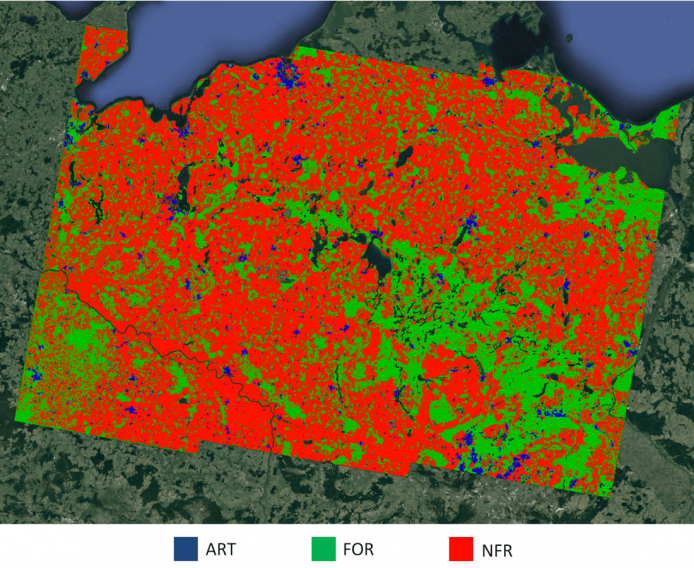
Featured image : Derived classification map, superimposed to Google Earth. Blue: artificial surfaces (ART), green: forests (FOR), red: non-forested areas (NFR).