ADNET (HR)
Apart from being known for its natural and historical heritage, Croatia is also recognised as a place with great renewable energy potential. At the same time, Croatia is grappling with dangerous seasonal forest fires, which are also a great challenge for the power network control. In the frame of an Implementing Arrangement with the Government of Croatia, ESA has overseen an Earth Observation-related project with ADNET, a Croatian software development SME who, together with the University of Zagreb Faculty of Electrical Engineering and Computing have developed a module for power network protection from wildfires using satellite-based information and other datasets.
Because of its unique geographical location and position, Croatia has mostly a Mediterranean climate with hot summers favoring the appearance and spreading of forest fires.
Although forest fires appear throughout the year, the most dangerous usually develop on the Adriatic coast during the summertime. Numerous forest fires also develop inland during the late winter and early spring. This is partly because of seasonal weed burning. Although intentional fire events are usually well-controlled and have no unwanted consequences, sometimes weather conditions can surprise, and fire events can become hazardous. In addition, research shows that lightning-induced fire events cause the greatest damage to the landscape and threat to power system infrastructure.
Power systems surround us with power lines, substations, power plants, etc. Their uninterrupted functionality is essential for sustainable modern life. Forest fires can significantly endanger power system objects with various consequences, e.g., power transmission losses, infrastructure damages, local or regional blackouts, etc.
In Croatia, forest fire danger prediction is based on the so-called Canadian method for fire weather index calculation. This is a well-known and widely used methodology. In the case of Croatia, the downside of this method is that during most of the high fire season, the resulting index stays constantly very high. Its utilization for practical applications is therefore limited. One possible workaround is to enhance the high-risk classes by the additional use of satellite-based information in the fire risk calculation. The main types of datasets for this purpose are land surface temperature (LST) and fire severity.
Through the SLSTR (Sea and Land Surface Temperature Radiometer) instrument, the Sentinel-3 satellite constellation of the Copernicus programme provides LST and fire radiative power (FRP) information that is valuable for estimating forest fire risk and spreading. These variables have specific high values before and during fire events. Using the SLSTR LST and FRP products together with statistics of historical occurrences of fire events and near real-time meteorological conditions, the project team has implemented various fire-related indices on the operational level.
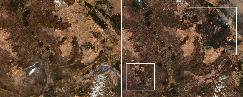
Besides the land surface temperature and fire radiative power, vegetation growth is another important parameter in fire behavior prediction that can be monitored remotely using various instruments, spectral bands, etc. The Sentinel-2 mission, a constellation of two satellites with a combined revisit time of five days, provides data in 13 spectral bands with spatial resolution of 10, 20, and 60 m. The combination of various spectral bands results in vegetation indices such as the Normalized Burn Ratio (NBR) and its pre-fire and post-fire difference, allowing landscape monitoring for fire danger prediction and post-fire vegetation recovery. Vegetation growth monitoring is key for multiple reasons, e.g., to assess and monitor the fire fuel content in the power system network infrastructure proximity and trigger maintenance work planning.
In the era of climate change, power system operation is more than ever before in its history endangered by various extreme weather events, like sudden storms, strong winds, floods, wild fires, etc. It becomes necessary to include various environmental and meteorological parameters in energy management systems (EMS) to limit the impact of hazardous weather events on safe power system operation. In this project, for the first time, environmental parameters have been included by using satellite data in the EMS to calculate fire risk indices and monitor vegetation growth. The products are included in the EMS at the operational level through N-1 contingency analysis calculation. The analysis calculation minimizes the eventual power network outage consequences and avoids blackouts.
This project we find as a very important step in enabling a resilient power system operation and limiting the risk of low frequency high impact weather events. Having an insight into the project and its results, several ideas for further exploitation of satellite data in our daily power system operational processes were generated. Our plan is to start working intensively on the power network protection from various aerosol contamination using Sentinel missions’ data and surface air quality measurements.
Tomislav Plavšić, Assistant Director, HOPS (Croatian Transmission System Operator Plc.)
