
Contemporary history was characterized by heinous crimes committed during numerous conflicts that violated international law. Since 1998, when it was established, the International Criminal Court (ICC) took over the task “to investigate, prosecute and try individuals accused of committing the most serious crimes of concern to the international community as a whole, namely the crime of genocide, crimes against humanity, war crimes and the crime of aggression.” [1]
The pursuit of justice requires evidence that can withstand scrutiny in court. For this reason, the ICC is enabled by its mandate to use a broad range of technological tools that can help its institutional functions in retrieving information and gathering elements to support investigations and law enforcement.
Bridging the gap between space and justice
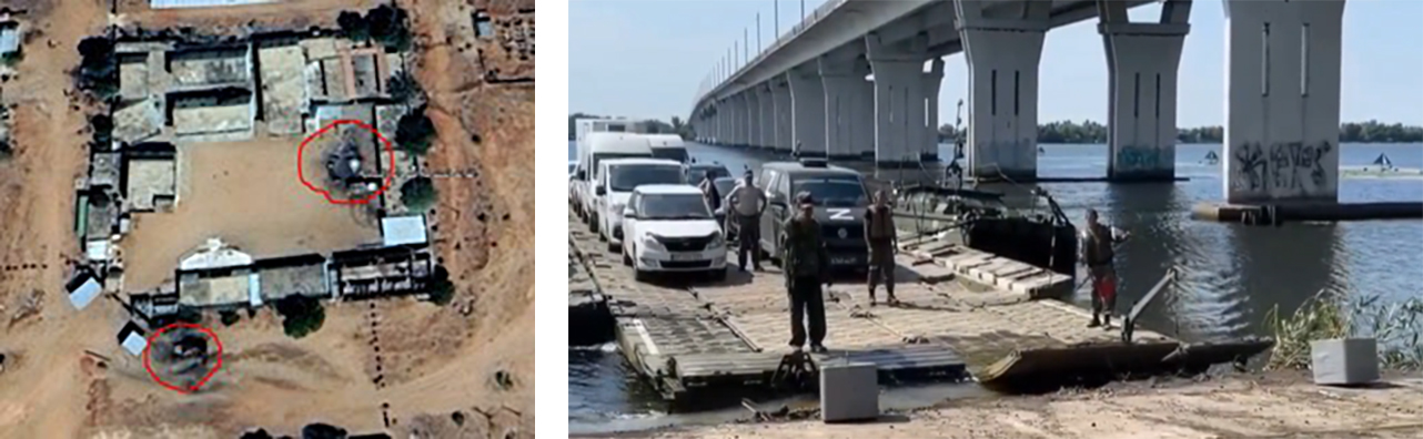
Earth Observation can provide critical data to corroborate events, monitor changes in landscapes, and document activity in inaccessible regions. Recognising this potential, ESA, “an intergovernmental organization dedicated to the exploration and use of space for peaceful purposes”, has launched several initiatives to accelerate the innovative use of Earth Observation in the following contexts:
- Providing EO derived information to support investigations and response to international and transnational crimes.
- Promoting increased use of geospatial information as corroborating evidence in court.
- Investigating and fostering the use of geospatial analysis in law enforcement investigations processes.
The main objective of the EVIDERI project was to develop and implement innovative services and tools that enable the ICC or authorities with similar mandates to manage and use information obtained from the analysis of imagery collected by Earth Observation satellite systems. By joining and compiling with other information sources such as Open Sources Intelligence (OSINT) and Social Media Intelligence (SOCINT), it is expected that a comprehensive understanding of the temporal and spatial context of criminal events will improve decision-making and law enforcement. This may be particularly relevant as gathering intelligence in war torn countries may be unsafe and challenging to access.
As part of the EVIDERI project, user requirements focused on the forensic use of products derived from analyzing satellite imagery combined with information and OSINT data.
Based on information requests (RFI) issued by the ICC, exemplary case studies were conducted to develop and define the complex process of creating products that can be used as evidence in war crimes investigations.
A phased approach has been implemented. First, as part of the analysis of earth observation data, the use of optical, Synthetic Aperture Radar (SAR), thermal or hyperspectral data was leveraged and the perspective of including the rapidly growing number of small satellites was considered. In parallel, this analytical process also included information gathering, such as event monitoring, conflict timeline, local media reports, change over time in areas of interests through OSINT and Earth Observation. The EVIDERI project team has then proceeded to the analysis, qualification, and validation of all the collected inputs. In a final step, meaningful products were provided to address adequately the RFI core questions.
In order to implement services and tools at authorities such as the ICC, security guidelines and highly standardized and qualified processes must also be considered so that data from different sources can be included and processed on a large scale.
Selected data must be checked for sources, attribution and provenance, credibility, independence, and impartiality as well as quality to be used as evidence. These criteria are paramount for the selection of suitable and reliable information, especially in the case of OSINT findings.
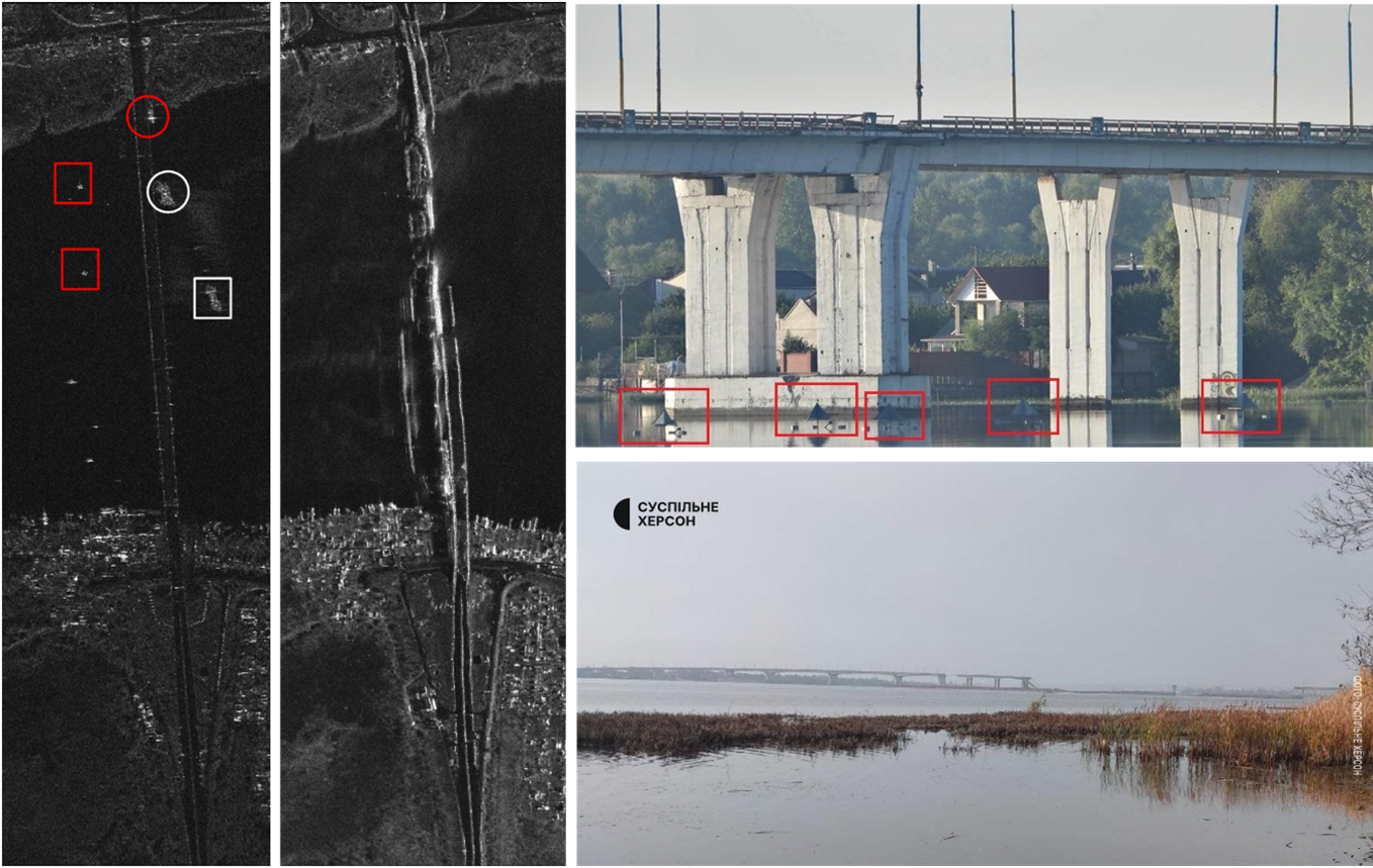
- For EO and geospatial data, criteria such as correct geolocation, spatial and temporal resolution, or coverage of the area of interest have been carefully examined and referenced. The availability and the selection of suitable optical and SAR sensors are crucial for the investigation of an RFI. Any manipulation of the input data must be checked and excluded so that the test results can be used as evidence at all.
- The integration of OSINT and GEOINT data provides another substantial layer of information to enrich the database for further use in the investigation process. Common keys such as date, location and/or names, event descriptions, metadata, and cross-references are critical to link together these different data.
When using extended systems which are able to process and join mass data, the quality of the results must be examined and crosschecked in any case. Depending on confidentiality requirements, the security aspects regarding data protection and storage, data transfer methodology as well as communication rules and paths must also be clarified.
Finally, the above-mentioned findings need to be transferred into highly automated procedures that will be able to transform incoming information into meaningful products for an RFI with the greatest possible care in terms of data selection, processing, credibility, and security aspects.
Christian Riesner, Lead of the Geoint Unit, International Criminal Court – Office of the Prosecutor said: “The impact of the EVIDERI project to the Office of the Prosecutor of the ICC is two-fold. First, the significant increase of staff awareness towards the application and capabilities of integrating EO and OSINT to leverage crime investigations. And second, the importance of a predefined structured (data-) approach when processing multi-sourced data.”
Would you like to find out more about this activity and EO capabilities for security applications?
Join the Advancing EO Capabilities for Security: Innovation, Adoption, and Strategic Partnerships session at LPS25 in Vienna. The session will take place on Friday 27 11:30-13:00 in Room 0.11/0.12.
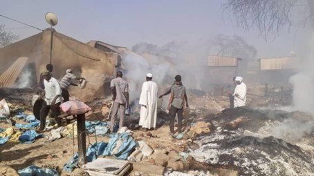
Featured image : VHR Satellite Image of a war crime area (Geoye, Maxar).
[1] https://www.icc-cpi.int/sites/default/files/Publications/understanding-the-icc.pdf (2020)