In the heart of the Swiss Alps, scientists are pioneering new methods to monitor glacier health with unprecedented precision. By harnessing satellite data and advanced modelling techniques, they’re gaining insights into the subtle changes in glacier mass balance, crucial for understanding water resources and the impacts of climate change.
Glaciers are sensitive indicators of climate variability, and their mass balance – the difference between accumulation and ablation – is a key metric for assessing their health. Traditional monitoring methods often rely on in-situ measurements, which can be logistically challenging and limited in spatial coverage.
A recently published paper, outcome of the research performed in the AlpGlacier project, illustrates a method to estimate the snow-covered area fraction (SCAF) of glaciers using Sentinel-2 data. This approach allows for sub-seasonal monitoring of glacier mass balance across the Swiss Alps without the need for extensive ground-based observations.
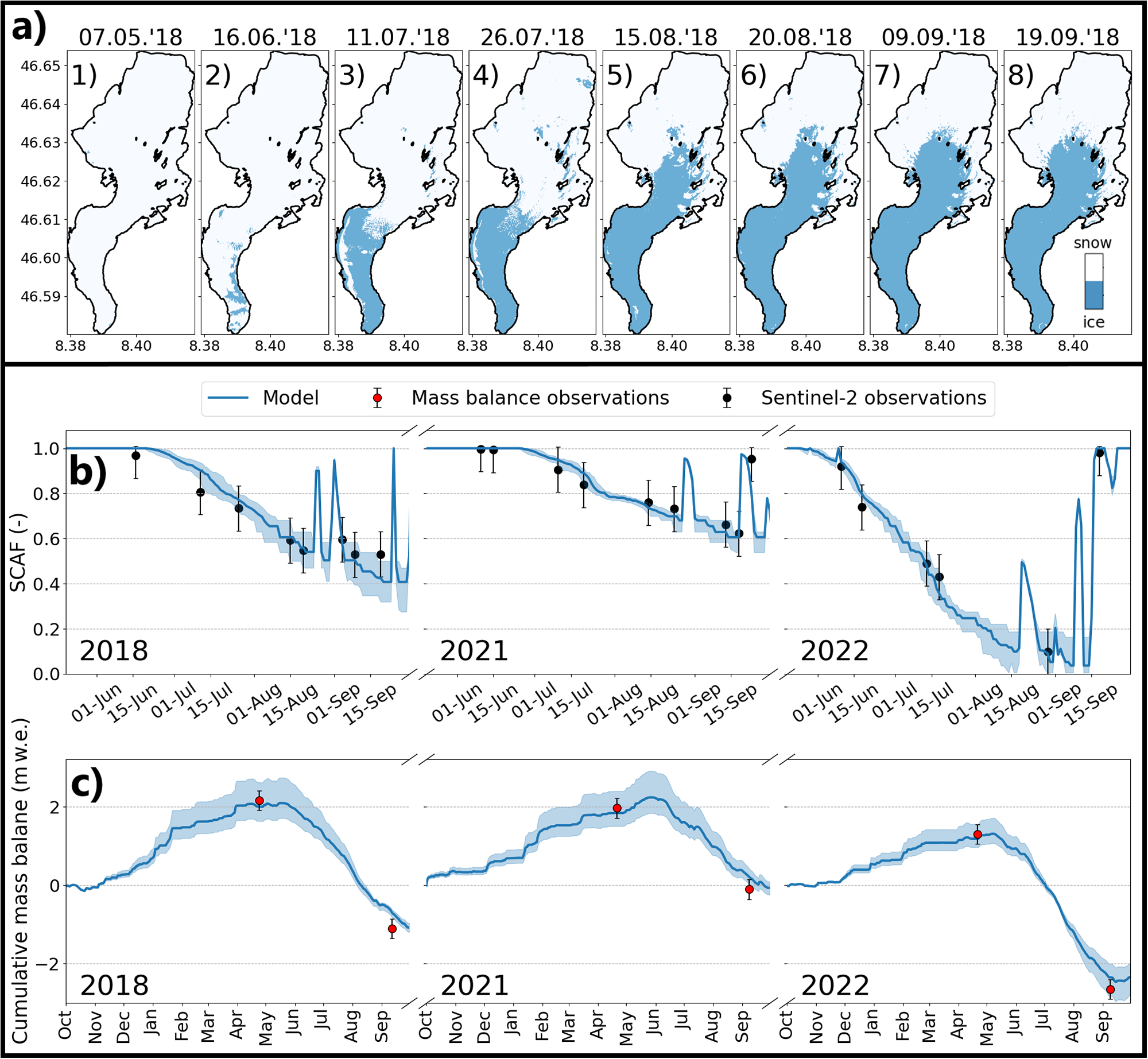
By integrating SCAF observations with long-term mass balance data, the method effectively separates accumulation and ablation components, addressing the challenge of parameter equifinality (meaning that different parameter combinations can result in the same ice volume change) in glacier modelling. Applied to ten glaciers from 2015 to 2023, this technique improved winter mass balance estimates by an average of 22%, with some cases seeing up to a 70% enhancement.
Tracking glacier movement
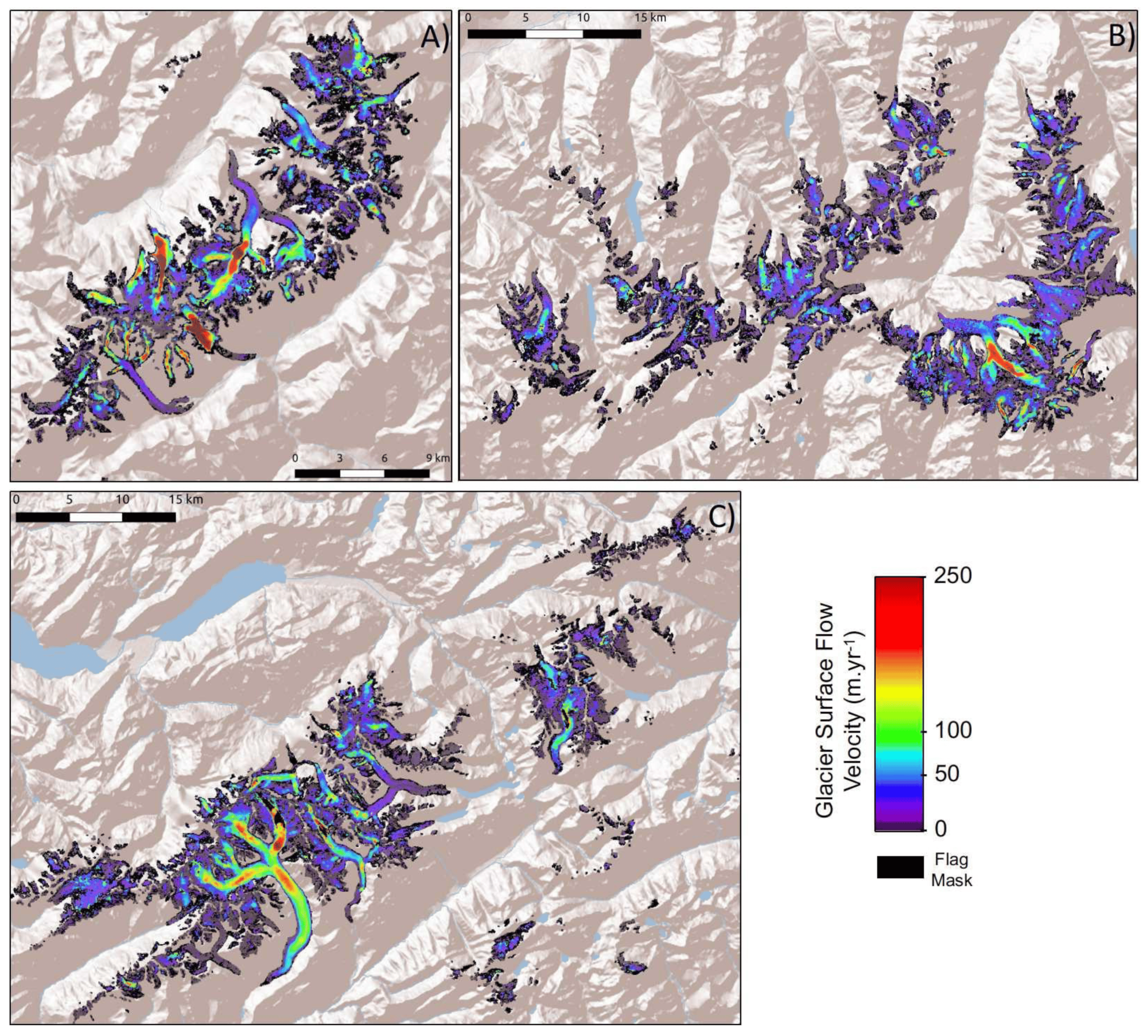
Beyond mass balance, understanding glacier dynamics involves monitoring their movement. Researchers from the same AlpGlacier project have also developed satellite-derived annual glacier surface flow velocity products for the European Alps, covering the period from 2015 to 2021. These datasets provide valuable insights into glacier flow patterns, contributing to a comprehensive understanding of glacier behaviour in response to climatic changes.
Implications for water resource management
The advancements in remote sensing and modelling of glaciers have significant implications for water resource management in alpine regions. Accurate, timely data on glacier mass balance and movement inform strategies for water storage, flood control, and hydroelectric power generation. As climate change continues to impact glacier dynamics, these tools become increasingly essential for sustainable resource planning.
Cremona A, Huss M, Landmann JM, Schwaizer G, Paul F, Farinotti D. Constraining sub-seasonal glacier mass balance in the Swiss Alps using Sentinel-2-derived snow-cover observations. Journal of Glaciology. 2025;71:e25. https://doi.org/10.1017/jog.2025.1
Rabatel, A.; Ducasse, E.; Millan, R.; Mouginot, J. Satellite-Derived Annual Glacier Surface Flow Velocity Products for the European Alps, 2015–2021. Data 2023, 8, 66. https://doi.org/10.3390/data8040066
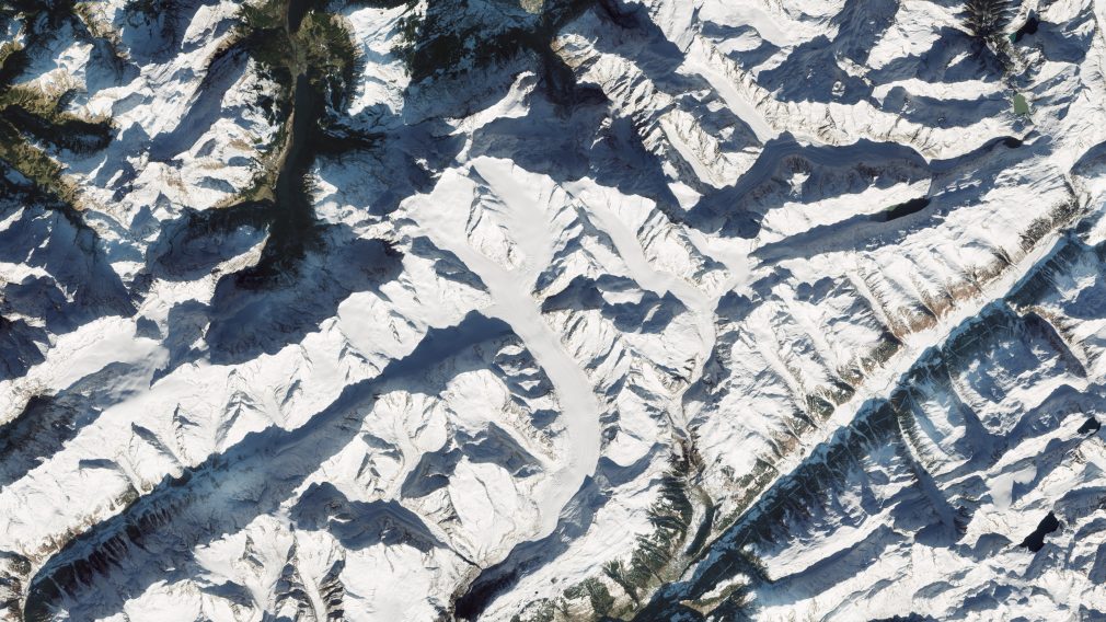
Featured image : Snow-capped Swiss Alps. Contains modified Copernicus Sentinel data (2024), processed by ESA