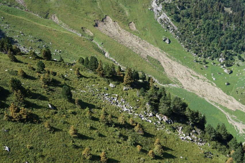
Landslides across the Alps have major socio-economic impacts and represent a significant risk for the population, properties and infrastructures as well as a serious hindrance in the development of mountainous regions. Landslides are diverse in form and mechanism, ranging from rockfalls and debris flows to deep-seated rock instabilities and shallow rotational soil slides. Those shallow landslides are one of the most frequent types, typically occurring within the upper (a few metres) layers of soil or loose surface material. Mostly triggered by intense or prolonged rainfall, these landslides sometimes involve a rapid downslope movement that can cause sudden and localised damage, particularly along vulnerable infrastructure such as transportation corridors. Most of the main Alpine transportation corridors are exposed to shallow landslide hazards.
An EO-fed, short lead time, automated processing chain
Historically, shallow landslide forecasting has faced significant challenges due to the lack of data and models capable of dynamically assessing landslide occurrences in space and time over large territories. The Digital Twin Alps (DTA) project developed an automated system that provides short lead time assessments of shallow landslide susceptibility and potential runout zones. Operating at a three-day forecast interval, the service produces a quantitative estimate of possible landslide occurrences triggered by meteorological extremes.
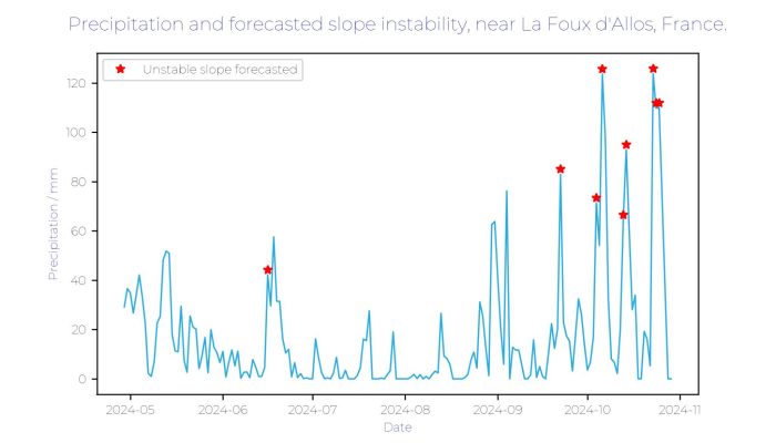
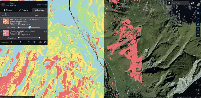
The forecasting chain integrates EO data (related to precipitation, as well as snow and land covers), numerical simulations and artificial intelligence. It works through a sequence of models: first, the Shallow Landslide Failure Forecast model estimates the probability of slope failures by combining static landslide source area maps with dynamic meteorological forecasts to identify susceptible zones and project the likelihood of landslide triggers up to three days in advance. Second, the Shallow Landslide Runout model, based on the Flow-R software, simulates the potential maximum propagation of the predicted landslide material. The landslide service uses inputs from high spatial resolution digital surface models and integrates landcover classes to approximate geo-mechanical and hydrological parameters.
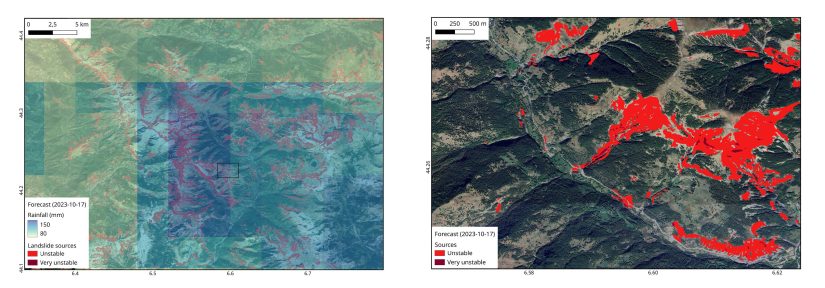
The service ran systematically from May 2023 to December 2024 on two Alpine territories: Entremont in Switzerland and Alpes-de-Haute-Provence in France, identifying areas where shallow slope failures are likely and where the sediment may propagate if mobilized. The products are now freely available to the public on the DTA web platform.
Helping stakeholders anticipate landslide disasters
The shallow-landslide processing chain of the Digital Twin Alps is a critical component for stakeholders requiring information on slope stability and potential sediment propagation. By leveraging landslide susceptibility maps, users can monitor evolving slope conditions on a daily basis, forecasting shallow landslide hazards both in terms of source and runout areas. This capability supports proactive planning by enabling stakeholders to anticipate landslide events and confirm operational strategies when necessary. Local authorities and civil protection agencies can, at first order, identify populations, settlements, and infrastructure that may be at risk, and possibly take measures.
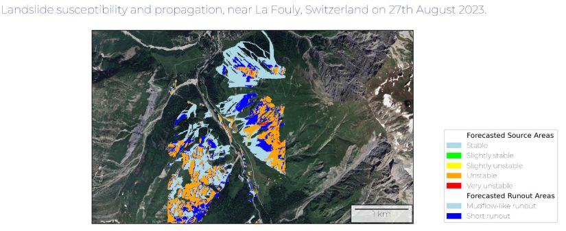
The current project team wants to bring the service to a more robust operational level by testing it with specific stakeholders, including civil protection and infrastructure managers (roads, railways), and adding additional features such as importing third-party vulnerability maps, triggering thresholds and an automatic alert module.
The service, together with the snow cover products for Alpine water management, demonstrates the value of Digital Twins in supporting decision-makers in designing preventive measures, coordinating the setup of mitigation strategies, and enhancing overall emergency preparedness. Moving forward, the focus will be on implementing additional instances of the DTA but also on working closely with interested stakeholders to help them understand and integrate Digital Twin capabilities into their operational workflows. This collaborative approach aims to ensure the long-term sustainability and practical application of Digital Twins in decision-making in the Alpine regions.
Featured image : Shallow landslide triggered in August 2024. Swiss Alps / Switzerland. Photo credit: Clément Michoud, Terranum Sàrl

