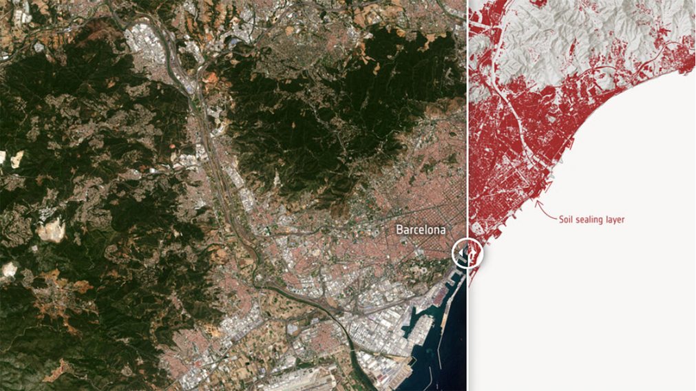
Soil sealing, caused by urban development, poses serious environmental threats, from flooding to biodiversity loss, to exacerbated urban heat island effects.
Soil sealing maps – at 10m resolution – along the entire Mediterranean coastline, spanning the period 2018-2022, have been generated from Sentinel-2 data within the Ulysses project, a Mediterranean Regional Initiative Land activity.
Featured image: Sentinel -2 image of Barcelona and its corresponding soil sealing map for 2022. Data source: ULYSSES project