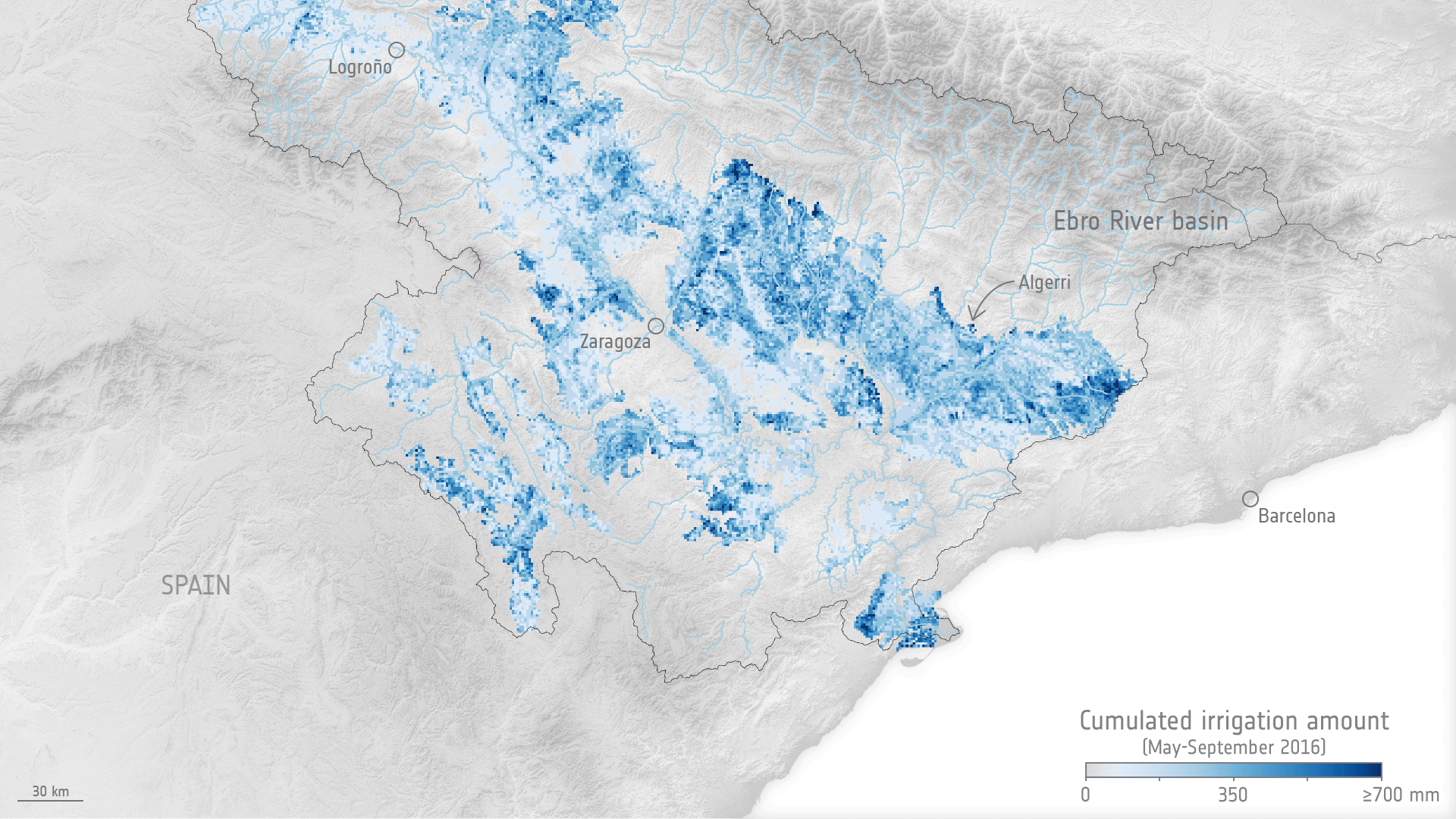
A recent paper published in Earth System Science Data presents a breakthrough in irrigation data sets obtained from satellite observations. The study, conducted as part of the EO Science for Society Irrigation+ project, focuses on three major river basins with varying irrigation extents and methodologies, namely the Ebro river basin in northeastern Spain, the Po valley in northern Italy, and the Murray-Darling basin in southeastern Australia. The data sets provide high-resolution (1 km and 6 km) irrigation estimates using soil-moisture-based inversion approaches, with weekly temporal aggregation.
The results show promising performance of the satellite-derived irrigation products, particularly in the semiarid regions of the Ebro and Murray-Darling basins, where median values of root mean square error (RMSE), Pearson correlation coefficient (r), and bias fall within acceptable ranges. However, the assessment of the Po valley is limited by the availability of in situ reference data for irrigation. The developed data sets are made accessible to the scientific community for further use and validation, providing valuable information for better understanding irrigation dynamics and water use patterns at a regional scale.
The availability of high-resolution irrigation data sets from satellite observations can greatly contribute to addressing knowledge gaps in irrigation and supporting effective management of agricultural water use, with irrigation being the primary source of freshwater consumption by humans and expected to increase in the future due to population growth and higher living standards.
Read the full story on ESA EO page.