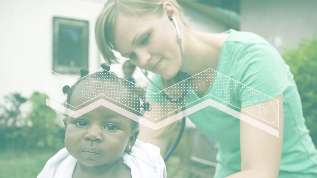
Are you interested in the role of EO in the health downstream sector?
Don’t miss the opportunity to learn about it by attending the upcoming Living Planet Symposium in Bonn, next 23 -27 May – registration is now open.
Here’s a selection of scientific sessions and agora discussions you may want not to miss. You will listen and talk to a number of distinguished speakers, delving into interesting topics.
| TUE 24 | Earth Observation for Health SCIENTIFIC SESSION – 8:30-10:10 – Room 14 (H2-O2) The last 18 months have shown us, if we were not aware of it before, of the fragility of human health, and of the need to work collectively, at the global scale, to conquer pandemics of deadly, infectious diseases. It has reinforced the importance of the “One Health” concept: the inter-connections of human health at the global scale has been brought to the fore, and there is enhanced awareness of the need for a healthy global population, if health within a nation is to be sustained. Geo-spatial technologies have become indispensable for track-and-trace of infection routes; for timely and effective delivery of medical services; and for provision survival packages to those who have been hit hard. More generally, Earth observations have proven to be helpful in understanding the environmental controls on vector-borne and water-borne diseases; in providing advance warning; and generating risk maps. But these efforts remain dedicated to small study areas and to particular diseases, with no substantial effort to integrate across regions or across diseases. In the wake of global economic downturn following the covid pandemic, there are projected decreases to health-related aid flowing from rich countries to poorer ones, with associated increased risks to millions of lives vulnerable to ‘neglected tropical diseases’, according to WHO (https://www.bbc.co.uk/news/uk-57506479). Many experts are of the opinion that more waves of covid outbreaks awaits the world in the near future, and that more global-scale outbreaks of new diseases from hitherto unknown sources are likely. Climate change, with associated increases in extreme weather conditions (floods, droughts, heat waves), warmer oceans and changing circulation patterns are likely to expand the geographic areas vulnerable to water-borne diseases such as cholera, according to experts. Faced with these threats to human health that are associated with environmental conditions, it has become an imperative to explore better use of resources available to the space sector, for control and mitigation of disease outbreaks, as well as to use Earth Observations to maintain and improve ecosystem health, towards meeting sustainable development goals, and hence to improved human health. The session will contribute to the conference objective “understand Earth systems” by pushing the boundaries of our knowledge regarding ecosystem health and its relation to human health and to theme Sustainable Development. It will also contribute to objective “empower the green transition”, by developing deeper understanding of how sustainable management of planetary resources and building resilience to threats from infectious diseases is related to ecosystem health. The session will be open to contributions on the use of Earth observations, geospatial technologies, and social media, to identify threats to human health (e.g., from air quality or water quality); to provide warning to reduce health risks; and to facilitate remedial actions and response measures in the event of disease outbreaks. Illnesses that are directly linked to environmental conditions (such as breathing disorders that are associated with air quality), and infectious diseases whose propagations are linked to environmental conditions (such as atmospheric conditions and vector-borne diseases, or water quality and water-borne diseases) fall within the scope of the session. Submission of work coupling epidemiological and other health-related models with environmental data for forecasting disease outbreaks is also encouraged. The role of smart phones for managing human health is also within the scope of the session.
Earth Observation data in Vector Borne Diseases SCIENTIFIC SESSION, 10:40-12:15, Room 14 (H2-O2) Vector-borne diseases (VBDs) are an important threat with an increasing impact on public health due to wider geographic range of occurrence and higher incidences. Identifying suitable environmental conditions across large areas containing multiple species of potential hosts and vectors can be difficult. Climate change, ecological conditions, global travel and trade, rapid and unplanned urbanization, are key factors affecting the geographical and seasonal distribution of vectors’ population and thus influencing the transmission of pathogens, causing the spread of VBDs to countries where they were previously unknown. The introduction of a VBD in a new area is often linked to host movements or other long-distance ways. Once a VBD is introduced in a new area with a large number of susceptible hosts, its establishment and spread are mainly constrained by the spatial and temporal distribution of the competent vector presence and abundance, under a permissive climate. The climate and the environment strongly influence the presence and distribution of vectors responsible for significant human and animal diseases worldwide. A fine understanding of the vectors’ habitat suitability that facilitates survival, reproduction and dispersal becomes therefore of paramount importance for determining the risk of local persistence and spread. Recent and future years offer a deluge of remote sensing (RS) and Earth Observation (EO) data, thanks to the collection of land and sea surface characteristics at high spatial and temporal resolutions with a wide number of spectral bands (land surface temperature, normalized difference vegetation index, soil moisture, etc.). The characterization of physical environments can now be performed at multi-scale levels, opening new challenging opportunities in vector borne studies. The session will present the latest scientific advances on the use of Earth observations for Vector Borne Diseases, discuss opportunities and challenges and will identify the road map to move from big data towards great value for Public Health. Chairs: Dr. Annamaria Conte (Istituto Zooprofilattico Sperimentale dell’Abruzzo e del Molise ), Dr. William Wint (Environmental Research Group Oxford Ltd) Digital Health Trends and Opportunities for EO Commercialisation TALKING BUSINESS – 16:25-17:25 – Agora GEMINI It is estimated that digital products and services will grow to a market share of 12%, or nearly EUR 1 trillion, within the total healthcare sector by 2025 worldwide (and around EUR 232 for Europe). COVID-19 is expected to accelerate this digital transformation which will see a paradigm shift in medical care, moving from “reactive” to “preventive”. On European level an increasing policy push from pan-European organizations (e.g. balancing the negative impacts from Covid-19, cross-border sharing of health data, strengthening and creation of new health related EU agencies) provides an opportunity for ESA to develop new strategic relations and activities and ensure a systematic integration of space technologies in the health sector. Satellites can support areas such as pandemic & disease surveillance, population and health management, but also the incorporation of environmental risks including air pollution, into planning, decision making and monitoring. This session hosted will explore emerging domains in the health sector and invite industry leaders and stakeholders to discuss trends, needs, challenges and opportunities for the exploitation of EO derived data. Industry panellist will join the discussion in a round table format. Chairs: Thomas Crone (ESA) |
| WED 25 | Advances and EO Applications in Remote Sensing of Marine Litter and Debris SCIENTIFIC SESSION – 10:40-12:20 – Room 2 (Nairobi 3-4) Remote sensing of marine litter and debris is now an emerging research field, attracting increasing interest and funding, with the goal to contribute to the monitoring of an environmental problem that poses socioeconomic and health risks to humankind. Since the introductory session on the topic held at the LPS 2019, several international projects have been assessing the detection capabilities of different remote sensing technologies and techniques, from space and airborne platforms, and for both direct and indirect observations of, in particular, plastic pollution in aquatic environments. This session will present some of the most significant advances in this field, will highlight the current remote sensing limits and the most promising remote sensing approaches in terms of present and future technologies and techniques by using different space and airborne platforms, and the most relevant potential EO applications, including potential services. The session aims at providing an evidence-based perspective on what is more likely to be, and not to be, achieved in terms of detection capability of marine litter with remote sensors in the short and medium term, what are the identified technical gaps, and what realistic monitoring approaches and EO applications could be more effective for contributing to the monitoring and resolution of this environmental problem, consequently helping to better direct future research initiatives and funding in the field. Chairs: Dr. Laura Lorenzoni (NASA/Headquarters, Washington DC, USA), Dr. Paolo Corradi (ESA) |
| THU 26 | The role of Earth Observation in climate services SCIENTIFIC SESSION – 8:30-10:10 – Rhine Lobby This session seeks to explore the role of earth observation in climate services, in the context of the Paris Agreement. In Article 7.7c, Parties to the UNFCCC are called on for “Strengthening scientific knowledge on climate, including research, systematic observation of the climate system and early warning systems, in a manner that informs climate services and supports decision-making In the context of earth observation, decision-scale science brings multiple challenges. Namely:
We welcome submissions related to all aspects of the climate services and data operationalization pipeline. Chair: Dr. Jean-Noel THEPAUT (ECMWF), Dr. Lothar Schüller (European Organisation for the Exploitation of Meteorological Satellites (EUMETSAT)) |
| FRI 27 | Nature-based solutions for resilient, sustainable, and healthy urban landscapes NETWORKING EVENT – 13:00-14:00 – Room 10 (H2-05) This event aims at gathering diverse stakeholder groups involved in the management of the urban environment, such as city administrators, botanic and forest experts, universities and research institutes and business actors working in urban environment such as architects and urban planners, tree care and nursery companies and multi-utilities. The Interactions among these players will provide insights and new findings about ongoing and future trends in urban environment and, specifically, about their information needs. A greener city is a healthier place for people to live, work and visit. Bringing nature into the urban environment incorporating green corridors, streets, parks and green space on buildings into a city boosts wellbeing, safety and prosperity but the positive effects of greenery in urban environments is more than beauty and health. Several European cities are planning to plant new trees (under initiative of the Municipalities or local Foundations) to make their environment more healthy and pleasant and are interested in getting suitable information for activity planning and monitoring the relevant impact, also to widely promote their initiatives at citizen level. Among these initiatives ForestaMI (3 million trees in Milan) and AlberItalia (60 million trees in Italy) are among the most remarkable ones. Satellite derived information can provide cost-effective, regular and timely information in support to public authorities as well as to business involved in city planning urban green management. The ESA funded MAFIS project is going to develop methods and algorithms for the analysis of ecosystem services provided by urban trees and green areas and will use the ESA Euro Data Cube framework to enable cooperation among the project partners and between them and the cities participating to the project (Florence, Rome, Paris, Wien, Milan, Bergamo, Lisbon, Kosice, Tirana)..
Digital Twin: 3D Modelling and Simulation for Cities ISSUE BRIEF – 14:00-14:45 – Agora EUROPA We all agree since the 70’s that Earth Observation (EO) data is key to understand human activity and Earth changes. However two trends today are forcing us to rethink the use of EO to tackle new challenges: – Georeferenced data sources, data quantity and quality keep increasing allowing global and regular Earth coverage; – AI and cloud storage allow swift fusion, analysis and dissemination of these data on online platforms. Combined together, these two trends generate various reliable indicators. Once fused together, they will allow the anticipation of future humanitarian, social, economic and sanitary crisis and the adequate action plan to prevent them from happening. Satellite imagery, 3D simulation, image analysis, mapping, georeferenced public and private data… we are getting enough tools to give the Earth a Digital Twin and this is not Science Fiction anymore. Airbus and Dassault joined forces to approach and reach this ambition focusing on cities. The project aims at automatically building a 3D digital model of cities as well as simulating their entire environment and using them as baseline to digitise impactful events. During LPS22, Airbus and Dassault want to explain the reasoning behind that project focusing on the evolution of urbanism but also taking into account environment, population from a sanitary perspective, economy and security layers. What we offer here is a global approach of Earth Observation, not just focusing on one topic, but answering myriad of problems. What better event to explain this advanced and innovative project than LPS22? Chair: Morgane Bonneau (AIRBUS) |