Chișinău is the capital and largest city of the Republic of Moldova and the country’s main industrial and commercial centre and transportation hub. While still being the least urbanised European country with over 55% of the population residing in rural areas (as of 2014), particularly Chișinău is expected to be faced with a strong inflow of new residents putting even more pressure on city’s infrastructure and services. Thus, the management of the urbanisation and rural-urban migration process has been gaining attention as one of the key national development priorities.
Both the Government of Moldova and the Municipality of Chișinău are interested in understanding the urban development patterns and in co-designing safe-to-fail experimental solutions to solve emerging problems or anticipate what might happen in the next 5–10 years. This has been the main justification for kicking-off the development of an Urban Mobility Plan for the city, supported by UNDP Moldova as part of the Moldova Sustainable Green Cities Project funded by the Global Environment Facility (GEF).
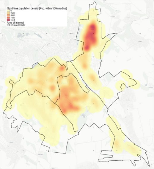
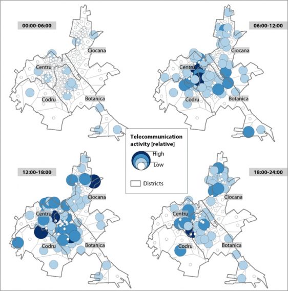
To support in the development of the Urban Mobility Plan, UNDP Moldova has requested Earth Observation (EO) support from ESA’s EO Clinic, a rapid-response mechanism for small-scale and exploratory uses of satellite EO information in support of a wide range of activities specific to international development. Two of the EO Clinic pre-qualified service providers (GeoVille and SIRS) analysed the Chișinău urban expansion patterns and types over time, identified typical day- and night-time distributions of the population and their mobility behaviour, the portion of the population that has convenient access to public transport as well as determined current infrastructure gaps. The analysis was performed by integrating non-EO data, e.g. mobility data provided by Orange Moldova. Work is underway to also include electricity consumption data and quality of life indicators collected from the local population through micronarratives.
The new mapping products and insights shall be used mainly by UNDP Moldova, the local administration of Chișinău and private sector companies to experiment with co-designed solutions to existing urban problems. Moreover, outcomes shall serve to further encourage the adoption of EO within UNDP Moldova and the Municipality of Chișinău. The goal is to expand the analysis to the entire Municipality of Chișinău and to advance the ideas and first results delivered to a more operational and integrated level.
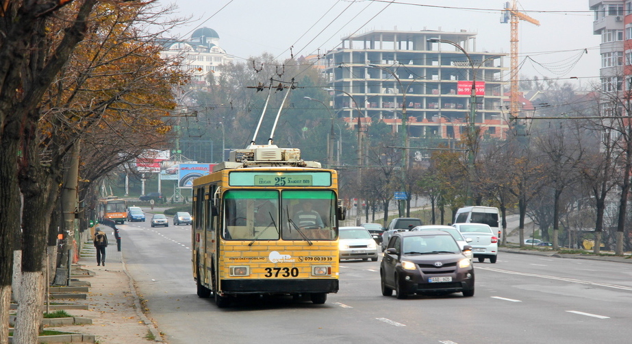
According to Dumitru Vasilescu, policy specialist at UNDP Moldova, “[…] one of the main issues related to urban development of Chișinău is urban mobility. There is a lack of adequate public transport capacities despite a growing population in the greater city area, resulting in substantial uncoordinated urban expansion and recurrent traffic jams. At UNDP Moldova we are excited to receive the support of ESA to explore satellite-based solutions to prepare and adapt the city infrastructure to the growing demand. In the longer-term, the intention is to transfer the lessons learned to other municipalities in the region and beyond, involving other UNDP country offices.”
Read about the collaboration also on UNDP Moldova’s pages.