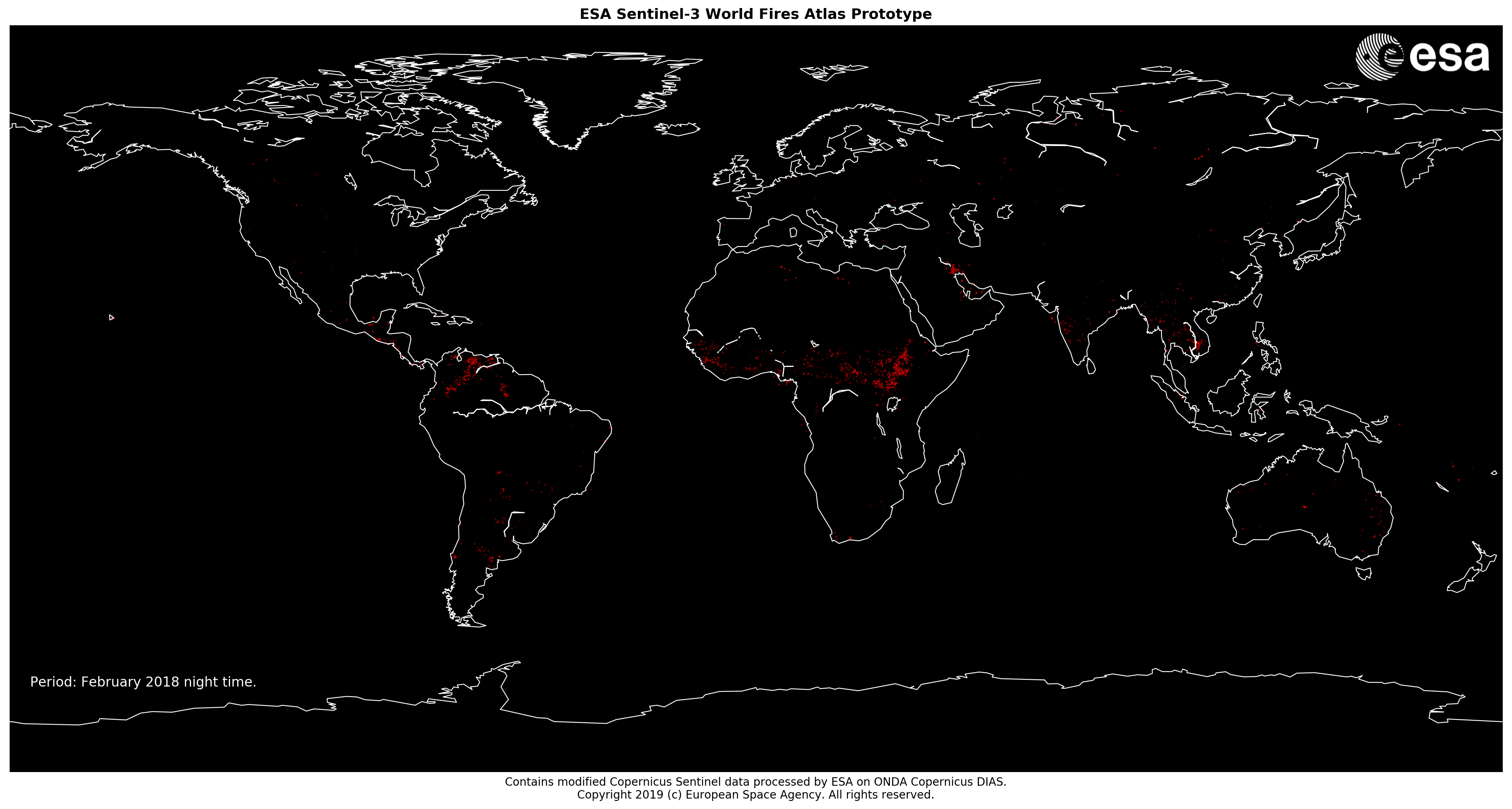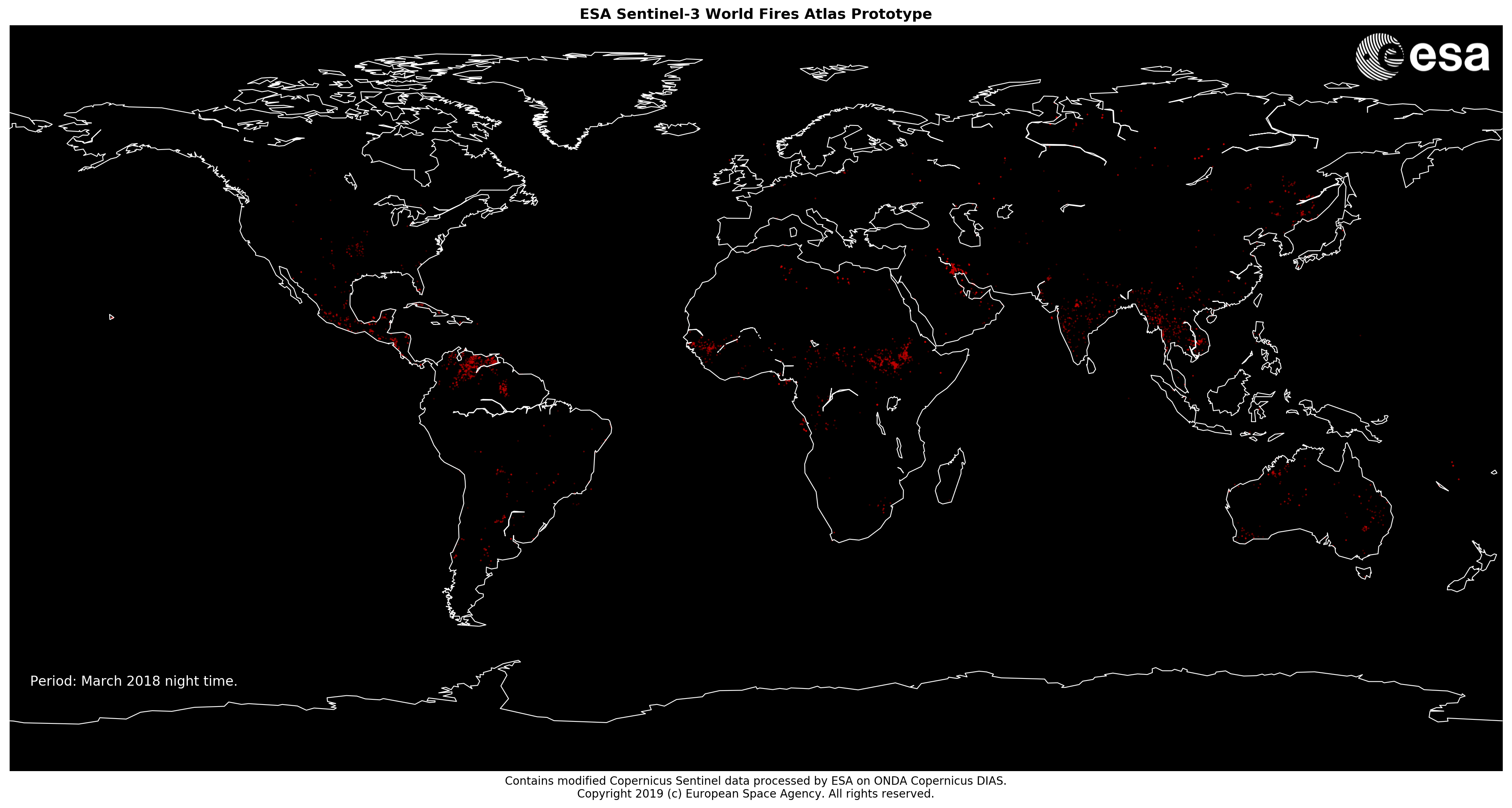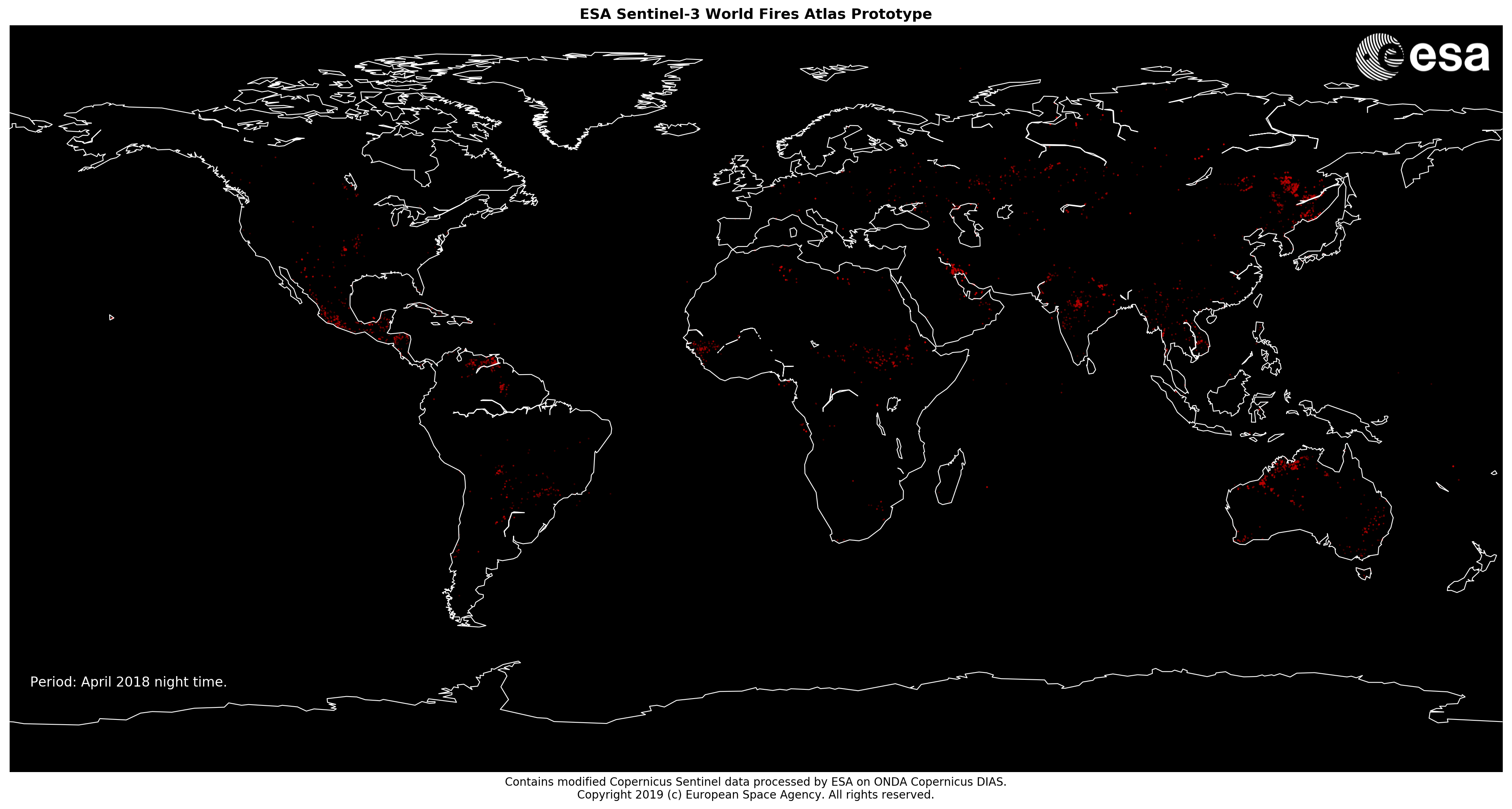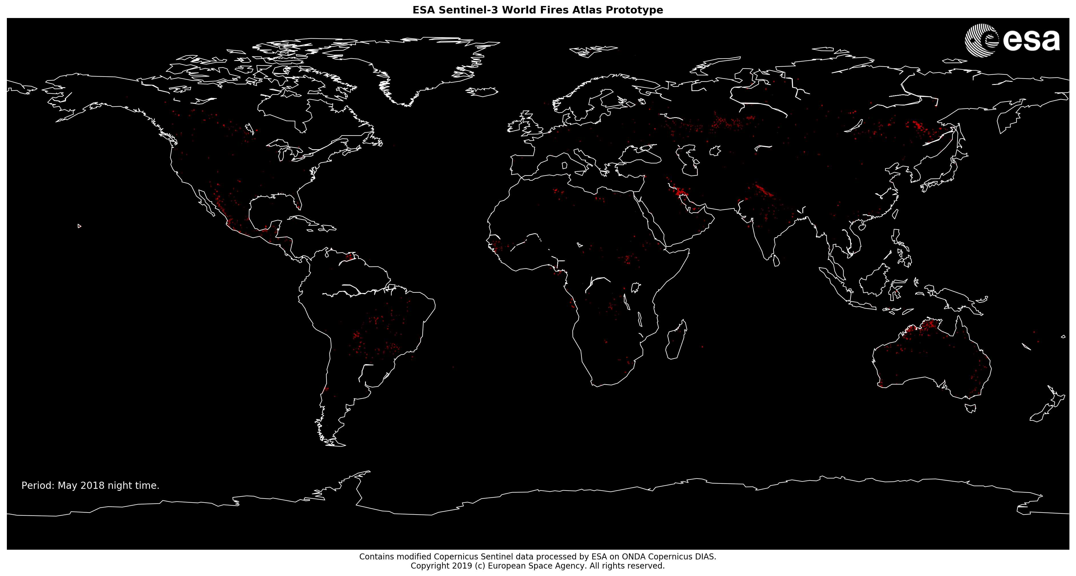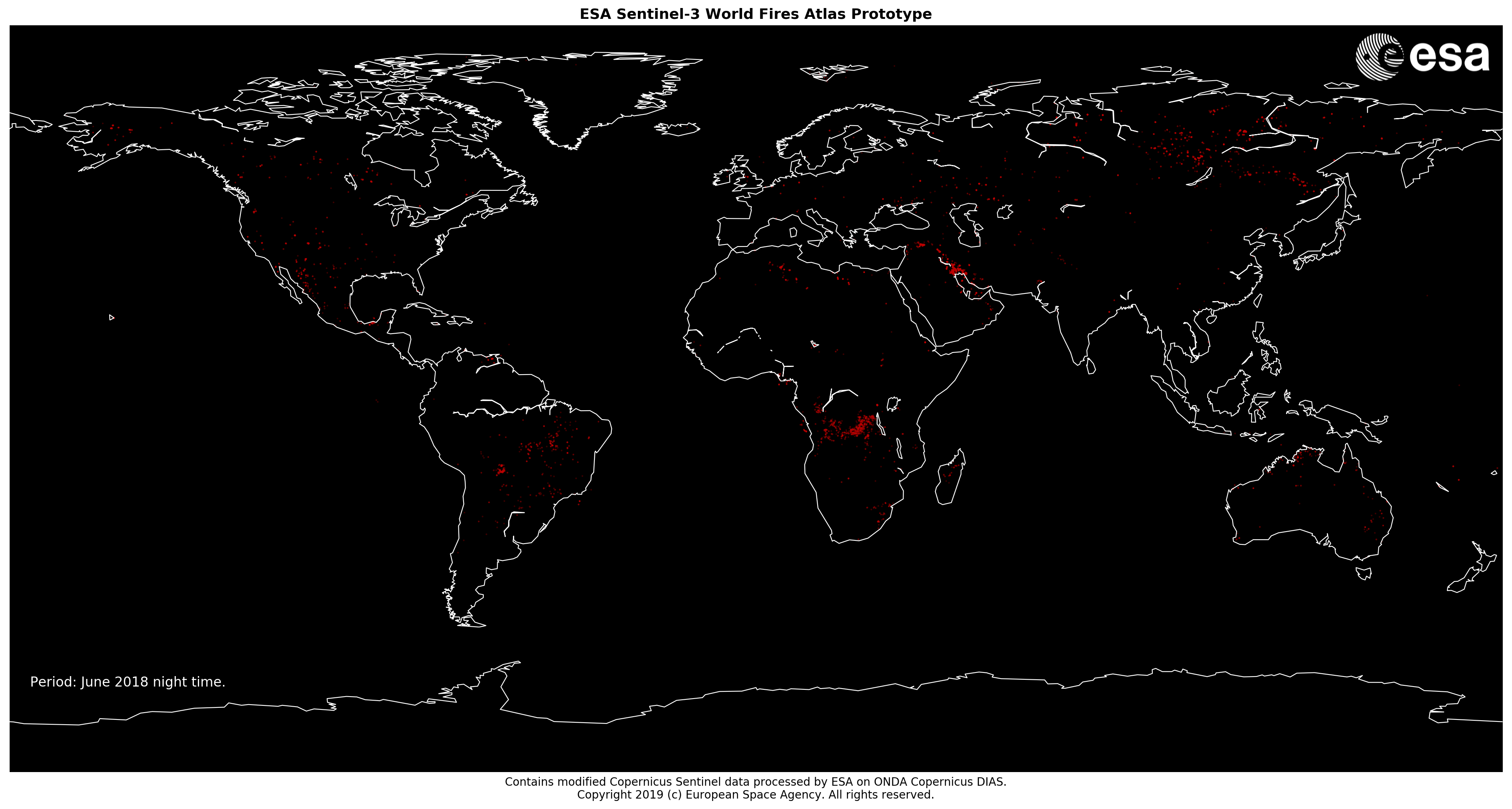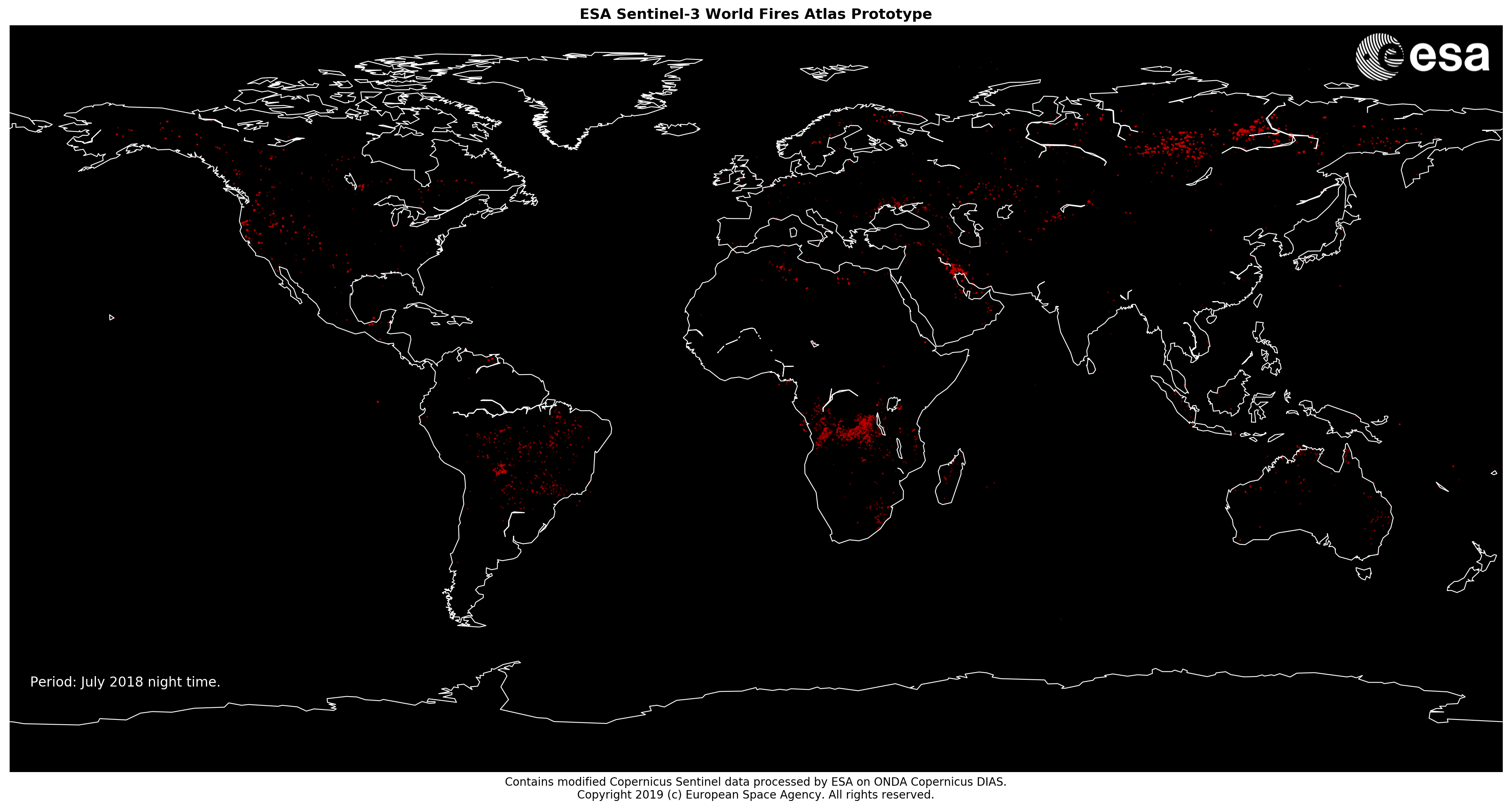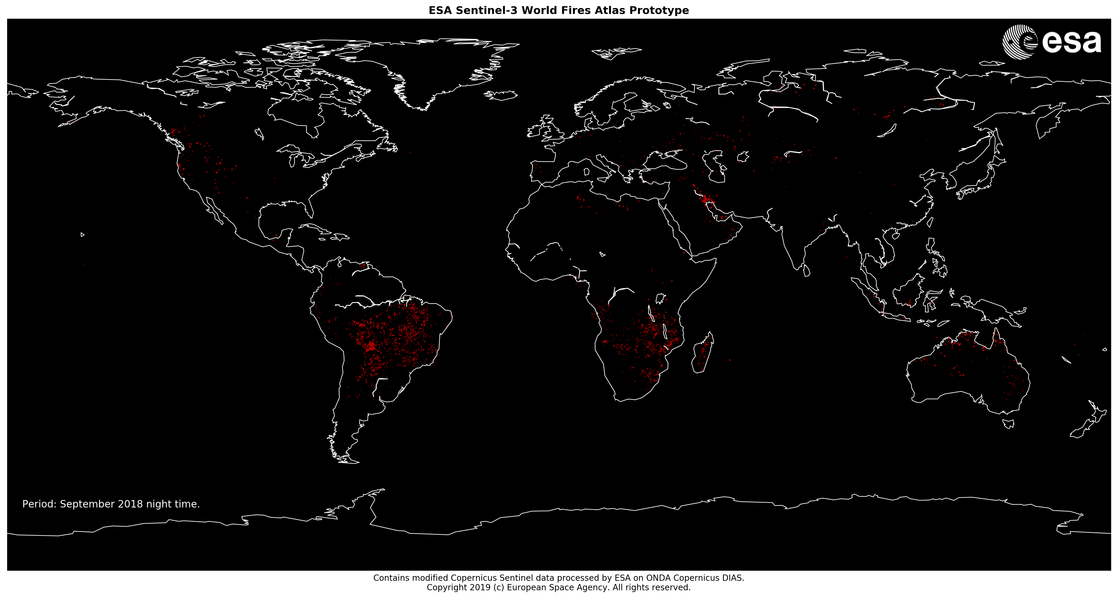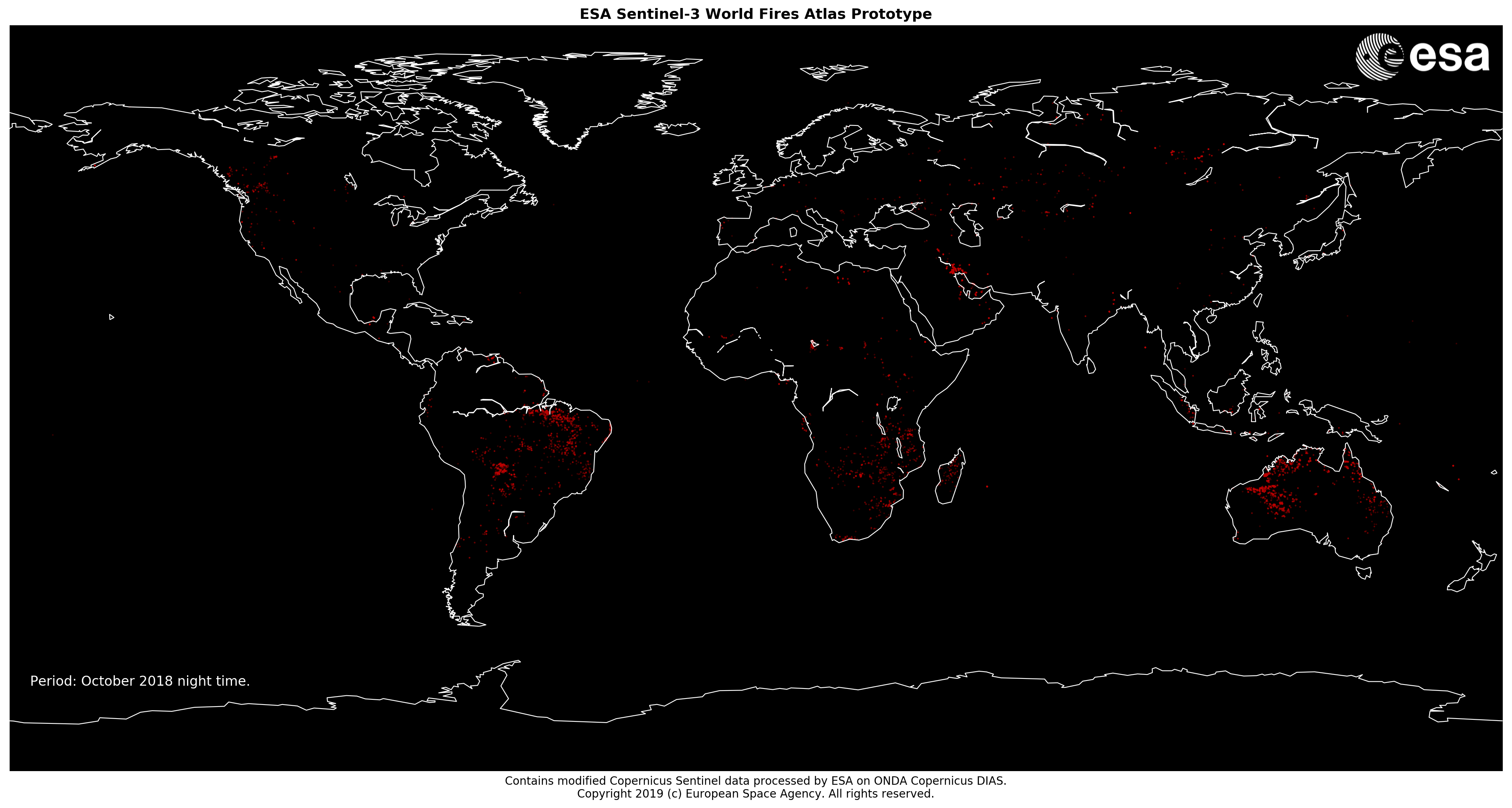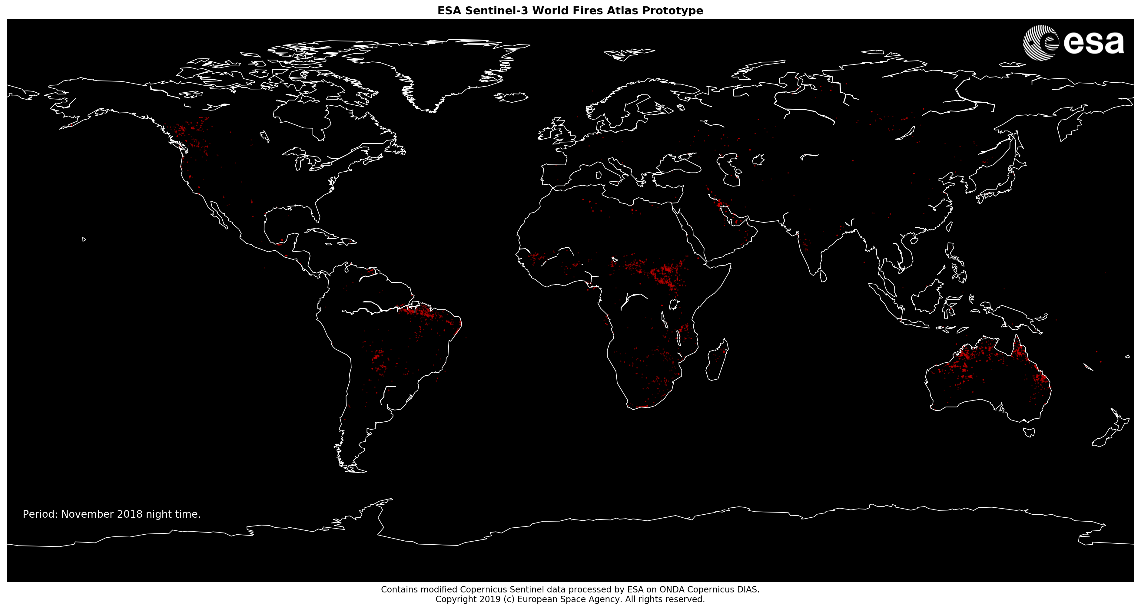
The Sentinel-3 World Fires Atlas Prototype product has been developed by European Space Agency over the southern countries of the ESA member states, using as input the Sentinel-3A and Sentinel-3B SLSTR Level 1b data containing two dedicated channels (F1 and F2) for fire and high temperature events.
The ESA Sentinel-3 World Fires Atlas Prototype aims to provide continuity to ESA ATSR World Fire Atlas (operating from June 1995 to March 2012) taking on board all the improvements of Sentinel-3 SLSTR instrument.
The processing chain is based on ESA SNAP and GDAL routines hosted in the ONDA Copernicus DIAS.
Two different algorithms, derived from a simplification of the work of Wooster et al. 2012, for day and night time have been developed, implemented and adapted to S3 SLSTR L1b NRT processing constraints.
Day-Time algorithm
For all valid pixels over land is applied an algorithm based on:
- Brightness Temperature of Sentinel-3 Fire channels acquired at nadir (F1_BT_in and F2_BT_in)
- Skin Temperature – auxiliary data provided by ECMWF [it is defined as the temperature of the surface at radiative equilibrium. It forms the interface between soil, snow or ice and the atmosphere]
- Contextual filters*, mean & standard deviation on 5×5 window, are applied in order to prevent false alarms
Night-Time algorithm
For all valid pixels over land is applied an algorithm based on:
- Brightness Temperature of Sentinel-3 Fire channels acquired at nadir (F1_BT_in and F2_BT_in)
- Contextual filters* (mean & standard deviation on 5×5 window) are applied in order to prevent false alarms
*Contextual filters derived from a simplification of the work of Wooster et al. 2012
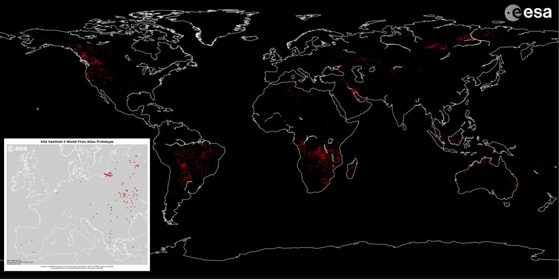
Two dedicated viewer are freely available to the users:
Near Real Time viewer
To visualise fire events occurred in the last 24, 48 or 72 hours on the map and their relative information available at http://s3worldfireatlas.esa.int/viewer. In addition a further option (available from May 2019) will allow the user to define an area of interest and receive a notification if new fires events are detected inside it.
Archive viewer
To visualise, defining a time range, fire events occurred over the southern countries of the ESA member states from 1st of January 2019 onwards is available at http://s3worldfireatlas.esa.int/archive. These results are based on Sentinel-3 SLSTR Level 1b Non Time Critical products.
ESA intends to process systematically all acquired Sentinel-3A and Sentinel-3B SLSTR Level 1b data from April 2019 onward over the southern countries of the ESA member states (Latitude from 34°N to 60°N; Longitude from 12°W to 31°E) and operate the prototype service up to end of summer.
Please be aware that the Sentinel-3 World Fire Atlas product is a prototype product and you are aware of the consequences of using a prototype that has not been validated.
In order to improve the ESA Sentinel-3 World Fires Atlas Prototype product and service, feedback from users are welcome by email at due@esa.int
Useful Links
- Sentinel-3 World Fire Atlas
- Sentinel-3 World Fire Atlas – Archive
- ATSR World Fire Atlas
- ESA Sentinel-3 World Fires Atlas Prototype – Overview
- Contact Us