GeoVille (AT)
EO Clinic support requested by: African Development Bank Group (AfDB), Urban and Municipal Development Fund
Requesting activity: AfDB African Cities Program: City Diagnostics and Action Planning
Requesting activity type: Technical Assistance (TA)
EO Clinic relevant Thematic Groups: TG2 (Climate Change), TG3 (Coastal Zone Management), TG4 (Disaster Risk Management), TG8 (Transport), TG9 (Urban), TG11 (Non-EO Information and Analytics)
Work Order number: EOC0025
Work Order status: Under Execution
Work Order start: 2021 Dec 16
Work Order end:
Rapid urbanisation and overwhelmed municipal administrations with insufficient resources lead to unplanned urban growth and insufficient infrastructure and service provision, negatively impacting sustainability and liveability of African cities. The results are uncontrolled sprawl, transit chaos, a widening infrastructure gap and environmental degradation. The African Development Bank’s African Cities Program tries to break this vicious cycle by providing evidence-based analysis and data for long-term development planning and by supporting cities with project preparation resources to turn plans into bankable projects, to be financed by downstream AfDB operations.
Launched in 2020 with five cities, the Cities Program is working intensively with selected cities to undertake a comprehensive city diagnostic and through this develop a detailed action plan for overall UMDF support. In addition to the broader UMDF support outlined, the aim of the Bank in the pilot cities is to prioritise investments, preparing at least one urban infrastructure project investment to take to market. Furthermore, the Bank will support these cities with trainings, learnings and dialogue, by connecting them to other cities in Africa and beyond, as well as other institutions in the urban development space. Through this the Bank will establish a network of reform-minded municipalities, working towards sustainable, productive and liveable urban development.
One critical barrier in the path towards sustainable urban development is the capacity to understand spatial data and use this data for planning of long-term city growth and infrastructure investments. Spatial data and the technologies related to it, such as remote sensing, can be powerful tools to overcome such barriers, allowing a better understanding of the dynamics of urban growth. Connecting development priorities and spatial data makes it possible to have a better localisation and specification of interventions.
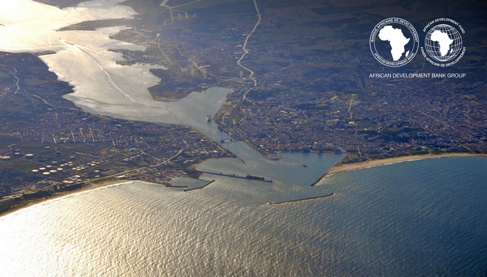
Geospatial data and maps are scarce in the Tunisian context, and typically outdated or of low quality. This often hampers understanding the spatial dimension and making of location-based decisions.
In the case of Bizerte city and governorate, the Bank and its partners are seeking to better understand the present situation and past evolution of the basic land use and land cover, trunk urban infrastructure and climate change risks in general.