GeoVille (AT)
EO Clinic support requested by: UNDP Armenia Office
Requesting activity: Mountain Forest Ecosystems Transformations Digital Platform
Requesting activity type: Technical Assistance (TA)
EO Clinic relevant Thematic Groups: TG6 (Forestry)
Work Order number: EOC0004
Work Order status: Completed
Work Order start: 2020 May 06
Work Order end: 2020 Sep 25
Armenia is located at the junction of the biogeographic zones of the Lesser Caucasus and the Iranian and Mediterranean zones and exhibits both a great range of altitudinal variation and a diversity of climatic zones. Together, this has resulted in a diversity of landscapes and ecological communities with a distinct flora and fauna, including many regionally endemic, relict, and rare species. Across much of the country, these landscapes face moderate to severe deforestation and overgrazing pressures, corresponding in high rates of erosion, increasing soil salinity, lowered soil fertility, and loss of biodiversity. The main cause of land and forest degradation in North-Eastern Armenia, where the majority of the forests of the country are located is the deforestation and overexploitation of forest resources.
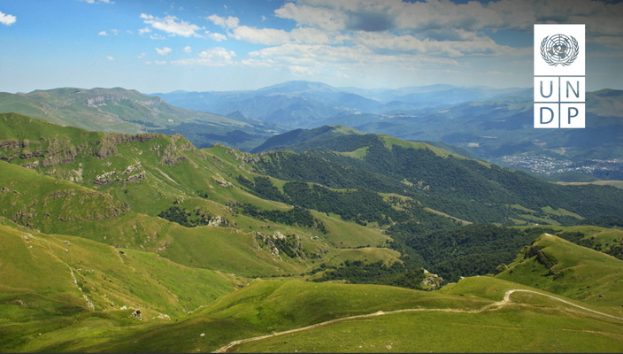
Dilijan National Park is one of the four national parks of Armenia. Most of it is located in Tavush Province. It is known for its forest landscapes, rich biodiversity, medicinal mineral water springs, natural and cultural monuments, and extensive network of hiking trails. The National Park was established in 2002 on the basis of the Dilijan State Nature Reserve, which in its turn was established in 1958 on the basis of the former Dilijan and Kuybishev forest enterprises. The change of the status from state reserve to national park was conditioned by several objective reasons, such as inevitability of commercial activity in the area, presence of numerous settlements, including Dilijan town with its mineral water resorts, Yerevan-Ijevan railway line passing through its whole territory and others.
Despite its unique biodiversity, rich natural-historical and cultural landscapes and huge eco-touristic potential, serious treats to ecosystems exists due to a dense population living within the national park, developed infrastructures, uncontrolled tourism, illegal logging, poaching and non-sustainable use of natural resources.
In order to support the Armenian government strategy to rehabilitate degraded forests and increase forest cover significantly, in the Dilijan National Park area UNDP Armenia is focussing its efforts to better understand the past forest ecosystems transformations, the land use and land cover changes, and in general, all the socio-environmental processes in the past and today that affect the sustainable management of forest resources. In the earlier project “Mainstreaming sustainable land and forest management in mountain landscapes of north-eastern Armenia” in collaboration with the Global Environment Facility (GEF), UNDP Armenia concentrated efforts on analysing seven forest enterprises out of existing 19 forest enterprises in country. UNDP Armenia is looking to develop an updated methodology for forest inventory and management, also including satellite EO inputs. A successful demonstration of the methodology could essentially ease the way for activities planned for the remaining 12 forest enterprises and protected areas.
The required EO services shall be designed to reveal important lessons on management efficiencies for the Dilijan area as a state reserve (before 2002) and for Dilijan National Park (since 2002). Understanding the impact of population, infrastructure development and increasing tourism the forest ecosystems is crucial to develop more effective management and nature conservation measures.