

The 2026 wildfire season has started early, with several European regions already experiencing significant fire activity, as highlighted by recent media reports (e.g. El País, Le Monde, The Guardian). Recent activations of the Copernicus Emergency Management Service (the European Union’s emergency response service) for wildfires in France and Spain further underscore the continued need for timely and reliable information to support emergency response operations.
Earth Observation plays an increasingly important role throughout the wildfire management cycle, from detecting active fires and mapping affected areas to supporting recovery efforts. During the recent Les Gavarres wildfires activation in Spain , OroraTech has been providing operational information to support the Copernicus Emergency Management Service rapid mapping activities. Daily satellite-derived fire hotspot information helps the rapid mapping team identify priority areas and optimise the tasking of high-resolution imagery for detailed mapping of burned and affected areas.

OroraTech’s FOREST satellite constellation supports the rapid identification of fire hotspots in priority areas, including afternoon observations that help close a crucial satellite detection gap when fire activity often peaks. The recent first light of the Hellenic Fire System, designed to scan the whole Greece twice a day, demonstrates the continued momentum towards dedicated technologies to face an ever-growing societal challenge.
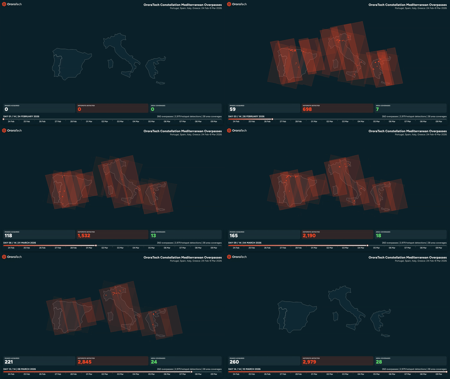
These more frequent and timely observations improve situational awareness for ongoing incidents and provide an important foundation for the next step: anticipating how fires may evolve.
Building on this evolution from observation to prediction, the FIRE-AID project is developing AI-based tools to support wildfire incident response and evaluation.
Deploying AI fire spread prediction from EO data
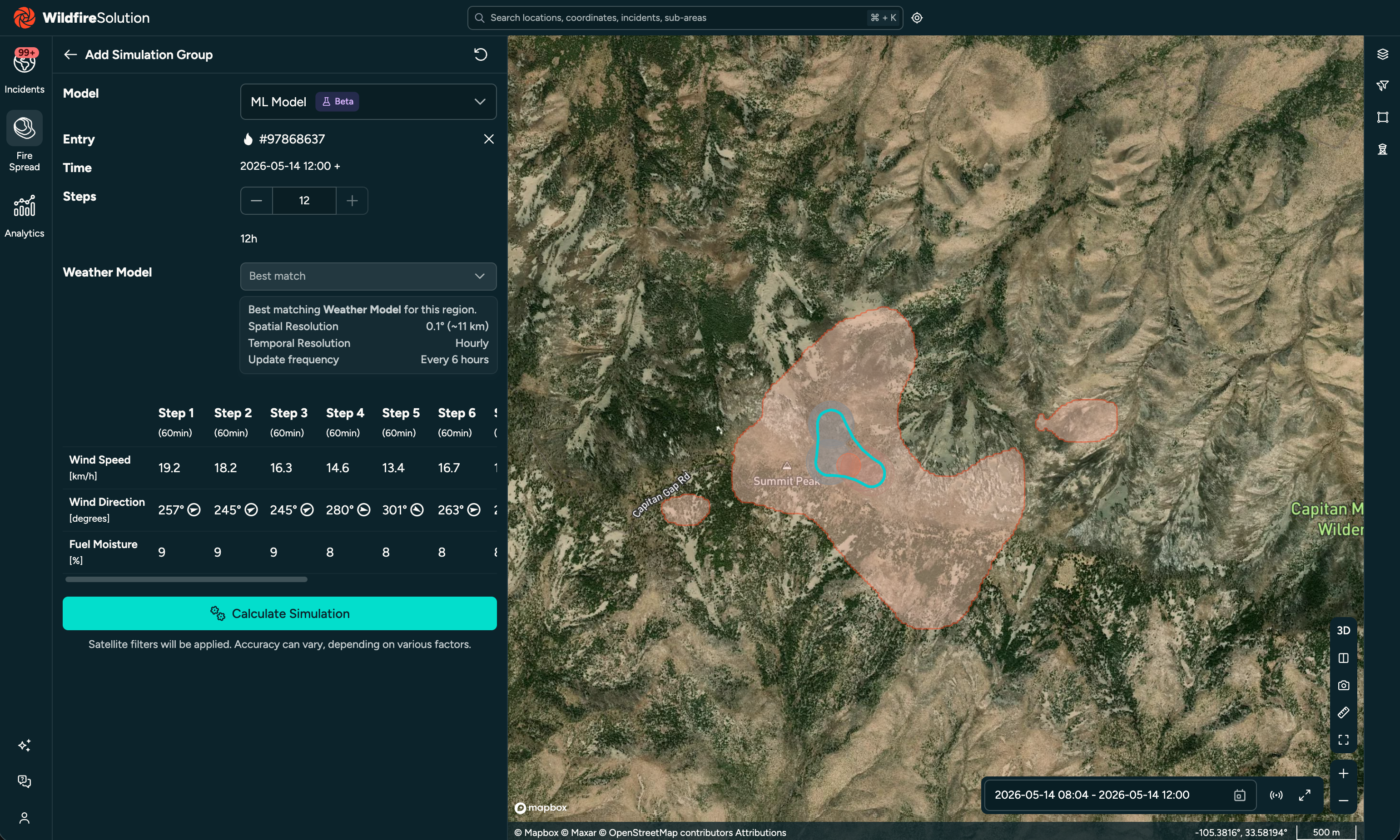
FIRE-AID has reached a key milestone with the deployment of its first AI-based fire spread prediction prototype within OroraTech’s Wildfire Solution platform. The prototype represents an important step towards integrating predictive wildfire intelligence into operational workflows.
The first use case focuses on forecasting wildfire progression based on recent satellite-detected fire perimeters. During upcoming demonstrations, users will be able to initialise predictions from observed fire boundaries and generate forecasts of potential fire spread for up to 12 hours ahead, visualised directly within the operational platform.
While the current prototype is designed as a first operational capability and is not yet intended to simulate wildfire spread across Europe at continental scale, it provides a foundation for future expansion. The service can already be applied to historical fire events, allowing researchers and stakeholders to compare model predictions with satellite-observed fire progression and systematically evaluate performance.
Combining satellite observations, environmental data and AI
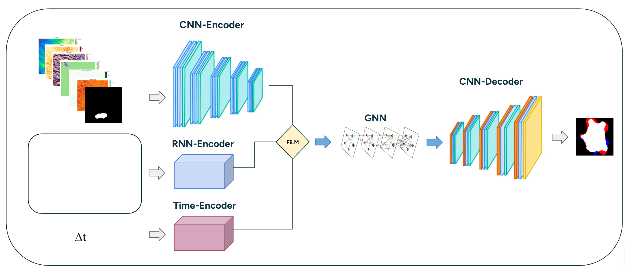
The FIRE-AID fire spread model is trained on a sub-daily wildfire progression dataset derived from OroraTech’s aggregated satellite-based fire archive. To represent the complex factors influencing wildfire behaviour, the dataset combines EO-derived fire observations with additional environmental information, including terrain, land cover, vegetation indicators and weather conditions.
The prototype uses a hybrid machine learning architecture that integrates spatial feature extraction, temporal encoding of meteorological conditions, and graph-based modelling of neighbouring areas that influence fire propagation. This approach enables the model to learn patterns of fire evolution and generate spatial predictions of future fire extent.
Towards operational wildfire forecasting
The latest FIRE-AID results were presented at the EGU26 General Assembly, and a short paper has been accepted for an oral presentation at the International Conference on Forest Fire Research (ICFFR 2026), taking place from 2–5 November 2026 in Coimbra, Portugal.
The next steps will focus on production deployment, structured stakeholder feedback, and detailed quality assessment. The project will also expand the training dataset to additional regions, improving the model’s ability to generalise across different wildfire environments.
By combining EO observations, operational wildfire intelligence and artificial intelligence, FIRE-AID aims to contribute to the next generation of wildfire response tools, moving from understanding where fires are today towards supporting decisions about where they may spread tomorrow.
Featured image : FOREST-9 acquisition over Laveno (Lake Maggiore, Italy) at different zoom levels, along with a screenshot of this scene as viewed in the Wildfire Solution platform. FOREST-9 was the first LEO satellite to detect the fire in Laveno on April 4, at 15:28 UTC. The fire was confirmed by AQUA 15 minutes later, followed by further confirmation from Meteosat-12 at 17:00 UTC. Courtesy of OroraTech.