
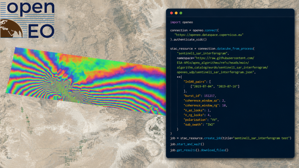
Processing Sentinel-1 interferometric SAR (InSAR) data traditionally requires substantial computing resources, complex software environments, and the management of large data volumes. With new InSAR capabilities now available as openEO User‑Defined Processes (UDPs) in the APEx Algorithm Catalogue, users can generate Sentinel‑1 coherence and interferogram products entirely within the Copernicus Data Space Ecosystem (CDSE), without downloading large datasets or maintaining local computing infrastructures.
The new workflows enable scalable InSAR analysis, opening new possibilities for environmental monitoring, surface deformation analysis, and other applications.
Cloud-native InSAR processing with openEO
Two new Sentinel‑1 InSAR openEO processes have been developed in the framework of the CLOUDInSAR project and are now available:
- SAR coherence – for generating geocoded InSAR coherence time series
- SAR interferogram – for generating geocoded interferogram time series.
A key design element of both workflows is burst‑level processing optimized for Sentinel‑1 TOPS acquisitions. By operating directly on individual bursts, the processing chains achieve high computational efficiency in cloud environments and support large‑scale, multi‑temporal InSAR analyses.
Behind the scenes, the InSAR processes rely on ESA SNAP, ensuring scientifically robust and well‑validated processing chains. From the user’s perspective, the underlying complexity of the InSAR workflow is fully abstracted, and the generation of geocoded coherence, as well as wrapped and unwrapped interferograms can be achieved in just a few lines of code.
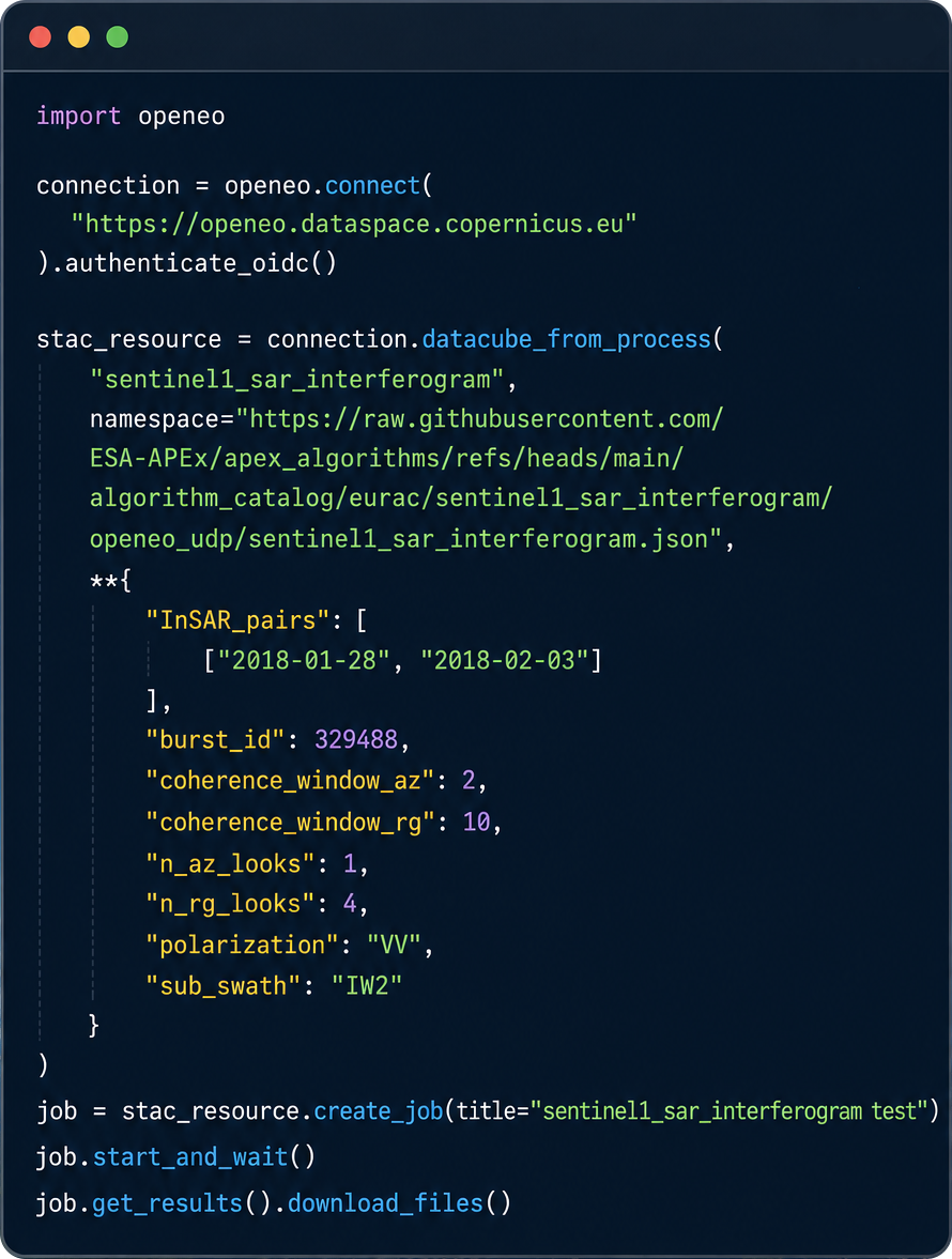
The new InSAR processes can be seamlessly combined with existing openEO building blocks, allowing users to create standardized and reusable graphs for a wide range of applications.
Two examples of testing the processes in real use cases are described below: debris-covered glacier detection and earthquake deformation monitoring.
Detecting debris‑covered glaciers with InSAR coherence
Mapping debris‑covered glaciers remains challenging for optical sensors, as debris‑covered ice often exhibits spectral signatures similar to the surrounding rocky terrain.
InSAR coherence provides complementary information. Moving glacier ice causes persistent phase decorrelation between acquisitions, leading to lower interferometric coherence compared to surrounding terrain.
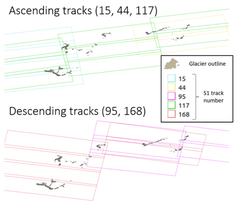
Using the new openEO Sentinel‑1 coherence process, coherence time series were generated for all glaciers in South Tyrol (Eastern Italian Alps). The processing covered 25 Sentinel‑1 bursts across multiple acquisition geometries.
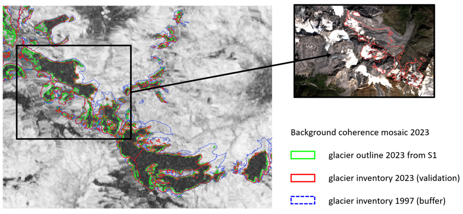
To improve robustness, multi‑temporal coherence mosaics were generated to reduce transient decorrelation effects caused by snowfall, rockfalls or other short-term phenomena. A threshold-based classification was then applied to derive glacier outlines.
The resulting coherence‑based glacier outlines were compared with glacier inventories derived from high‑resolution orthophotos and LiDAR data available through the Geo Browser Map View of the Province of Bolzano/Bozen.
Monitoring earthquake deformation with MintPy
Multi‑temporal interferometry techniques such as Persistent Scatterer Interferometry (PSI) and Small Baseline Subset (SBAS) are widely used for monitoring slow surface deformation associated with tectonic activity, permafrost dynamics, landslides, and infrastructure instability.
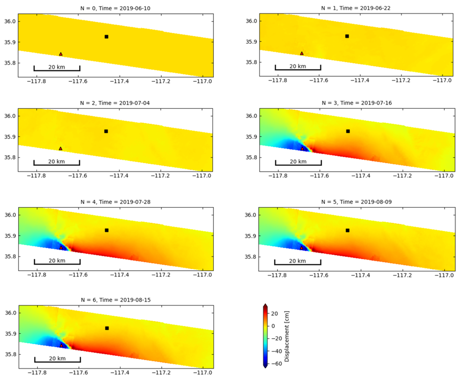
To test compatibility with MintPy, the openEO workflows were used to reproduce a reference MintPy Sentinel‑1 dataset for monitoring surface deformation associated with the 6 July 2019 Ridgecrest earthquake (California). The reference dataset, originally generated with ASF HyP3, consists of seven Sentinel‑1 acquisitions and eleven interferograms.
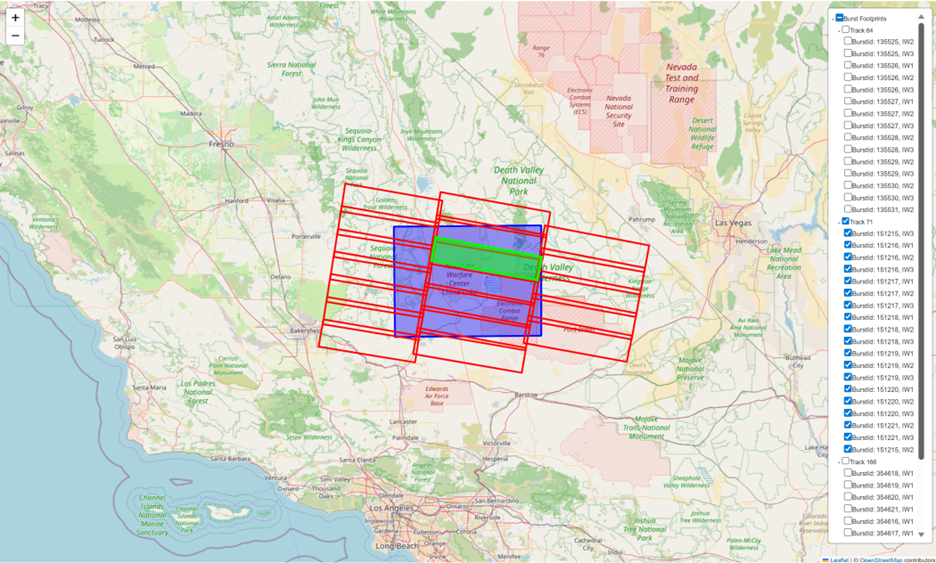
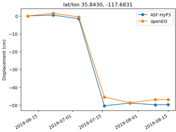
Interferograms generated with openEO were ingested into MintPy to derive deformation time series. The results show good agreement with the reference dataset generated using ASF HyP3, confirming both scientific consistency and technical compatibility.
Explore the new openEO InSAR processes
The new openEO InSAR processes can be explored through the project GitHub repository, which includes example notebooks for both applications presented here. Additional documentation is available through the APEx Algorithm Catalogue.
Each openEO process execution uses computing credits, but getting started is easy: users benefit from 10,000 free credits every month, allowing you to run multiple openEO InSAR workflows, test your ideas, and explore large‑scale InSAR processing at no cost.