Methane is one of the most potent greenhouse gases driving climate change, responsible for nearly 30% of global warming since pre-industrial times. Rapid identification and mitigation of methane emissions is therefore a critical component of global climate strategies.
However, detecting methane emission sources at global scale remains challenging due to the large volume of satellite data, atmospheric variability, and the complexity of distinguishing real emissions from background noise.
Combining satellite data and advanced AI
The AI4CH4 project addressed this challenge by developing an end-to-end artificial intelligence framework capable of automatically detecting and quantifying methane plumes from satellite imagery. The project combined advanced AI methods with multi-mission Earth observation data to create a scalable monitoring system capable of identifying methane super-emitters across the globe.
The system integrates data from multiple satellite missions with complementary capabilities.
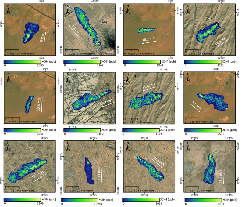
Sentinel-5P, equipped with the TROPOMI instrument, provides global daily coverage suitable for detecting large methane emissions, while Sentinel-2 offers higher spatial resolution observations that allow detailed characterization of localized methane plumes.
By combining these complementary datasets, the AI4CH4 framework enables both large-scale screening and precise source identification.
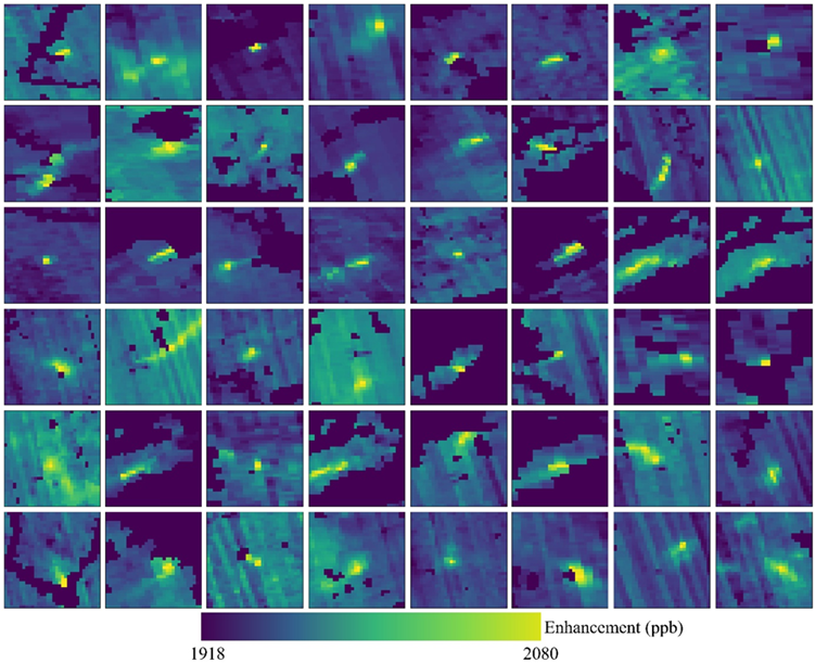
At the core of the system are advanced deep learning models designed to automatically recognize methane plume patterns in satellite imagery. These models were trained using a comprehensive benchmark dataset that combines real satellite observations and simulated methane plume scenarios. The project explored a range of modern AI techniques, including convolutional neural networks, vision transformers, and automated segmentation approaches capable of extracting plume boundaries directly from satellite images.
A fully automated, robust processing chain
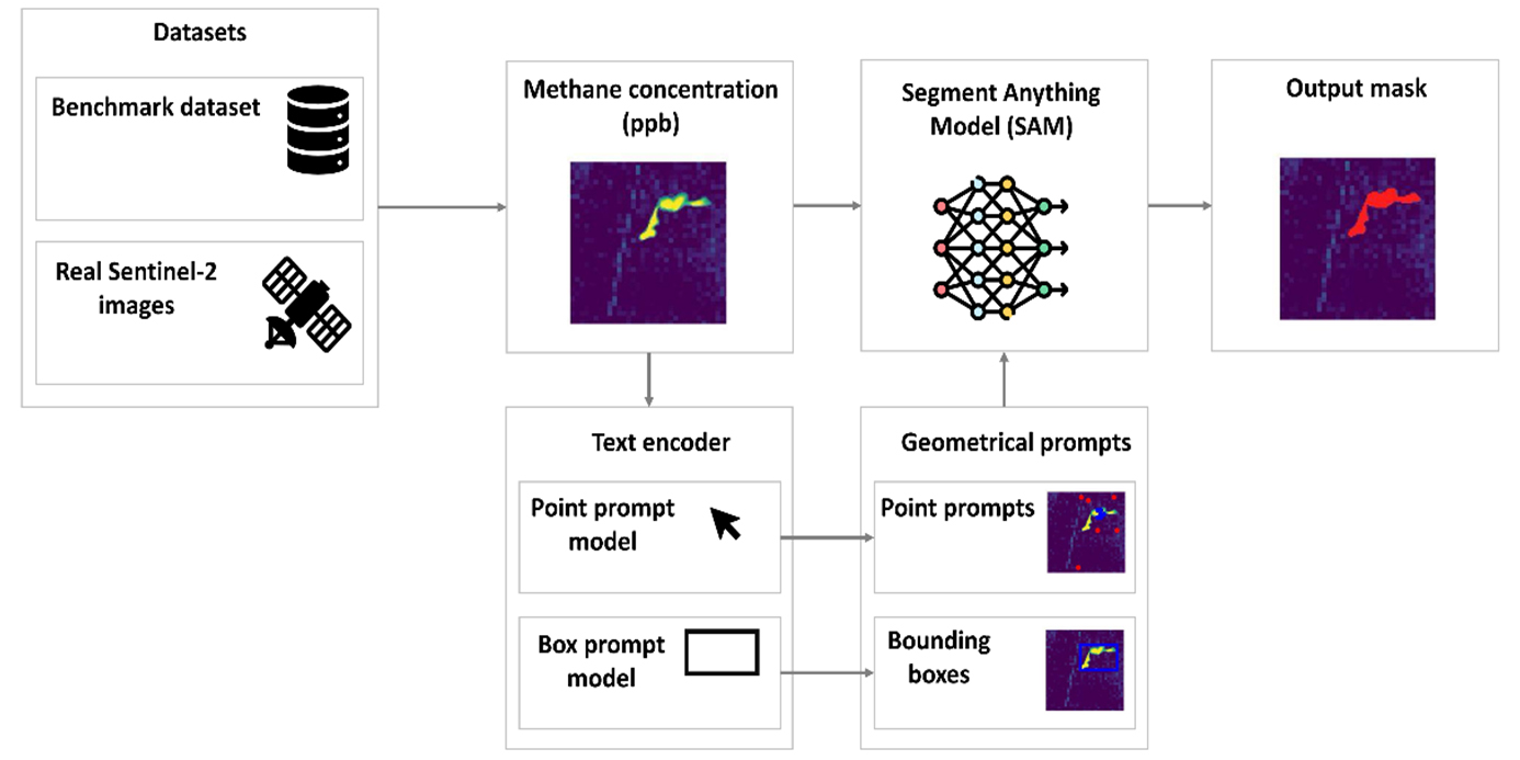
A key innovation of AI4CH4 is the use of foundation AI models for automated plume segmentation, which significantly improves the accuracy and efficiency of plume detection. By integrating models such as the Segment Anything Model (SAM) with vision–language frameworks, the system can automatically delineate methane plume boundaries and support reliable emission rate estimation.
The project also developed a fully automated processing pipeline that integrates satellite data ingestion, plume detection, emission quantification, and visualization into a single workflow. This pipeline enables continuous monitoring of methane emissions using freely available satellite data, reducing the need for manual analysis and allowing large-scale monitoring of industrial methane sources.
The AI models were validated using independent datasets and real-world case studies across multiple geographic regions. Results demonstrate that the developed AI framework can reliably detect methane plumes and estimate emission rates under a wide range of atmospheric and environmental conditions.
Breeding the broader scientific community
Beyond algorithm development, AI4CH4 produced a number of scientific and technical outputs that contribute to the broader Earth observation community.
The project generated multi-mission benchmark datasets, developed operational AI models for methane monitoring, and produced five peer-reviewed scientific publications, three of which have already been published in leading remote sensing journals.