A new article, published in Geophysical Research Letters and led by Sara Jensen from DTU Space, demonstrates how ocean currents and eddies in the Arctic can be resolved at unprecedented resolution using the French (CNES) and US (NASA) Surface Water and Ocean Topography (SWOT) satellite.
The underlying research, funded in the context of the ESA Polar Science Cluster project Fresh4Bio, used high-resolution (2-km) sea surface height measurements from SWOT in a quasi-geostrophic assimilation model to derive ocean currents at 2-km resolution along the East Greenland Shelf and across the Nordic Seas.
In fact, the SWOT mission uses a wide-swath Ka-band Radar Interferometer (KaRIn) to deliver two-dimensional, high-resolution (up to 250 m) measurements of sea surface height across a broad swath, whereas standard nadir altimeters only provide one-dimensional observations along the satellite ground track. This allowed for resolving ocean dynamics at a smaller scale than what was previously possible using traditional altimetry measurements.
Quasi-geostrophic maps from assimilation of SWOT and nadir altimetry (foreground) and DUACS maps based solely on nadir altimetry (background) from 1 April 2024 to 26 October 2024: (a) ADT, (b) geostrophic current, (c) relative vorticity. White masked area has >75% sea ice concentration, and the magenta lines mark the 75% and 5% ice lines. The black line shows the domain of the model. Thin white lines are 500 m and 2000 m depth contours.
Ole Andersen from DTU , who leads the Fresh4Bio project, commented that “This work highlights the potential of SWOT to uncover ocean processes at new and improved resolution. These capabilities will be further enhanced in the future with the upcoming Copernicus Sentinel-3 NG mission, which will provide similar high-resolution altimetry observations”.
The mesoscale and sub-mesoscale dynamics revealed by this study, such as eddies, fronts, currents, and filaments with spatial scales between 5 and 200 km and temporal variability of days to weeks, play an important role in ocean circulation, with strong lateral and vertical transport of heat, salt, carbon, and nutrients. They also facilitate the exchange of these quantities across ocean‐atmosphere‐sea ice boundaries and are therefore important for local and global budgets of heat and carbon as well as biogeochemical cycles.
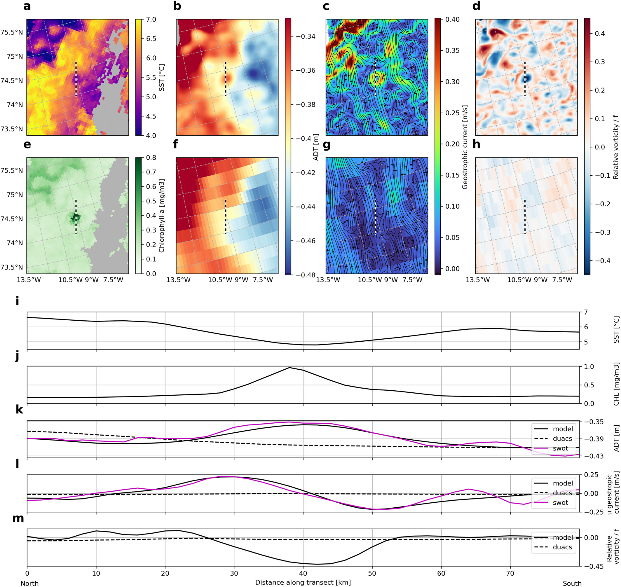
The team were able to validate the new results through comparison with satellite observations of sea surface temperature and chlorophyll-a to confirm the presence of eddies, which revealed that these eddies contained colder water and high chlorophyll levels, suggesting boosted phytoplankton growth by bringing nutrients to the surface.
“These new results help and complement our understanding of the complex and evolving ocean dynamics and marine productivity in the Arctic and particularly the impact of freshwater input from melting sea ice and runoff from the Greenland Ice Sheet, which is a key objective of the Fresh4Bio project”, remarked Martin Wearing, coordinator for the ESA Polar Science Cluster.
N. Jensen, O. B. Andersen, C. B. Ludwigsen, R. Gonçalves-Araujo, L. de Steur, Surface Water and Ocean Topography (SWOT) Observations Unveil Small Mesoscale Variability on the East Greenland Shelf. Geophysical Research Letters, Volume 52, Issue 21 (2025). https://doi.org/10.1029/2025GL118573
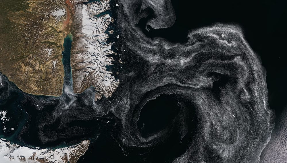
Featured image : A swirl of sea ice at the exit of Scoresby Sound on the east coast of Greenland is featured in this Copernicus Sentinel-2 image. Contains modified Copernicus Sentinel data (2022), processed by ESA