From May 12–16, 2025, the European Space Agency (ESA) participated in the World Climate Research Programme (WCRP) Global KM-scale Hackathon, a global event that brought together the climate modelling community to accelerate research using climate simulations at unprecedented kilometre-scale resolution (horizontal resolution < 10 km). Hosted simultaneously across ten international nodes spanning nine time zones – including Hamburg, Oxford, Beijing, Tokyo, three US locations, Australia, and South America – the hackathon united more than 600 researchers around the data itself, fostering live collaboration, simultaneous analysis, and hands-on experimentation with new technologies.
ESA’s ESRIN centre participated as an affiliate node to the Hamburg node, operating as a cross-cutting activity, termed the “Joint Analysis with EarthCARE”, in which EarthCARE data was utilized to mimic analyses performed on the simulated data. This was achieved by forming joint teams with science teams working on diverse topics ranging from understanding the morphology of stratocumulus clouds in model and EarthCARE data to tracking and analysing tropical cyclones and haboobs (dust storms) found both in the simulations and along EarthCARE tracks.
The challenges to tackle during this hackathon were manifold. On one hand, the kilometre-scale model required a new approach to handling simulated data – from computation to data access and workflows. On the other hand, integrating EarthCARE data introduced the challenge of working across different temporal and spatial scales, raising questions about how to enable meaningful comparisons.
The ESA role
The ESA team comprised a multidisciplinary group of Earth observation scientists familiar both with the technicalities of the mission and data, as well as climate science expertise. The team included:
- Saskia Brose, Young Graduate Trainee (YGT) in EO Data Processing & Management
- Beniamino Abis, EarthCARE Level-2 Payload Data Ground Segment (PDGS) Engineer
- Johanna Mayer, Blanka Piskala, and Arthur Avenas, Internal Research Fellows (IRFs)
- Karsten Peters-von Gehlen, Research data management at the German Climate Computing Center (DKRZ).
Together, they embodied ESA’s dual mission for the hackathon: advancing scientific collaboration and evolving technical systems for data dissemination. More specifically, ESA’s involvement served multiple strategic goals:
- Scientifically, to connect the EarthCARE mission – ESA’s sixth EarthExplorer mission focused on clouds, aerosols, and radiation – with the broader climate modelling community, fostering mutual understanding and interoperability between satellite data and model simulations.
- Technically, to leverage the hackathon as an opportunity for the PDGS to immerse themselves in the workflows and needs of scientists, to inform the development of ESA Mission Analysis and Application Platform (MAAP), a next-generation, cloud-native collaborative environment for EO data access and analytics.
- And in alignment with the WCRP objectives, improving understanding of climate extremes, advancing process-level insights, and building infrastructure for cross-domain collaboration.
Projects and collaborations
Throughout the week, the ESA team worked with a range of science teams across nodes, each focused on unique Earth system phenomena.
ESA brought EarthCARE data and PDGS expertise to the table, contributing to the following scientific projects:
| Stratocumulus clouds
Marine stratocumulus clouds exhibit a wide variety of spatial structures. The image below, taken by the MSI imager aboard EarthCARE near the African West coast over the Atlantic, illustrates the variety of cloud structures, ranging from clustered to disorganized, thin to thick, and closed to open cells. During the Hackathon, the ESA team collaborated with modelers to statistically analyze the spatial organization of stratocumulus clouds over the Atlantic, using on the one hand the EarthCARE MSI_COP_2A product and on the other hand various km-scale global models. The goal is to determine if km-scale models can reproduce the intricate cloud structures observed in Earth’s stratocumulus decks and, ultimately, their effect on the climate. 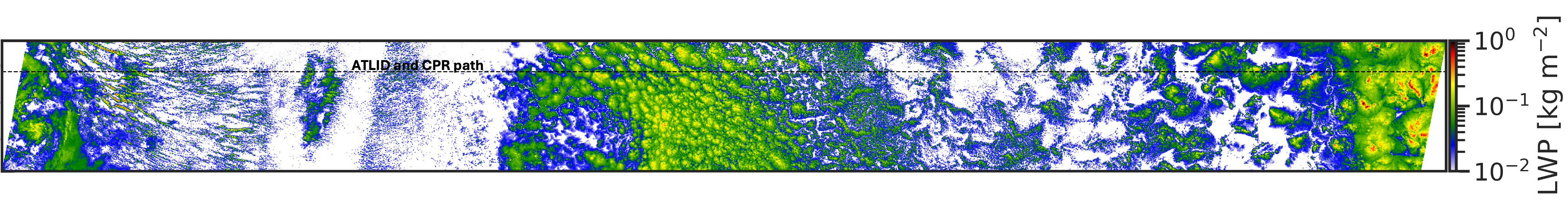 |
| Tropical cyclones
Tropical cyclones are intense atmospheric vortices that draw their energy from the upper layer of the ocean, characterized by a large spatial extent (several hundreds of kilometers) with a small eye size (a few kilometers to a few tens of kilometers), strong convective updrafts and large precipitation rates. Based on EarthCARE and C-band synthetic aperture radar (SAR) data, we analyzed the wind and precipitation properties of the simulated tropical cyclones. 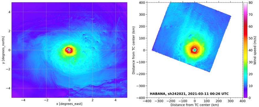 |
| Haboobs (Dust Storms)
Haboobs are intense dust or sandstorms carried by the wind of a weather front or thunderstorm and characterized by a wall of dust along the leading edge of the haboob. The image below, taken from EarthCARE’s MSI instrument and overlain with the path of the active instruments shows a haboob detected by EarthCARE. During the hackathon, we explored the options of comparing EarthCARE’s measured aerosol profiles with those from km-scale models to test how the models capture the vertical structure and concentration of dust.  |
| EarthCARE Curtains
The Curtain science team compared simulated data and EarthCARE observations along “virtual curtains”—vertical slices extending beneath the satellite’s path. To evaluate EarthCARE Level 1 (L1) products, the PAMTRA satellite simulator was used to generate reflectivity from physical model outputs, which were then compared to EarthCARE’s CPR L1 product. Additionally, the physical parameter cloud water content was compared between the ICON model and EarthCARE’s Level 2 (L2) product. 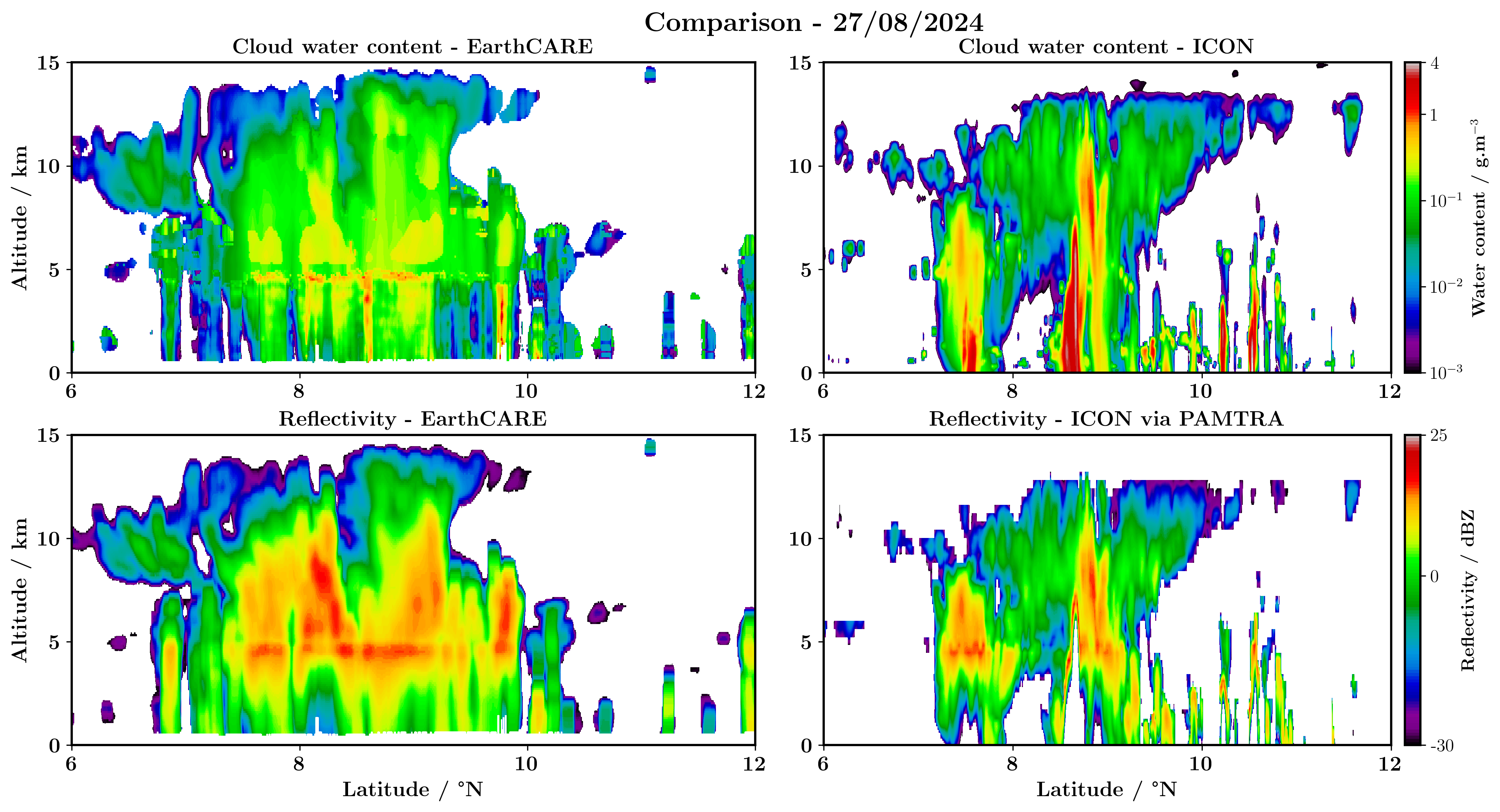 |
Looking ahead
The hackathon was a glimpse into the future of scientific collaboration. By participating in the global hackathon, the use of satellite data from EarthCARE was showcased to a broad modelling community, broadening the satellites impact, and collaborations were formed. Furthermore, technical systems like MAAP could be tested. Through initiatives like this ESA is supporting the groundwork for a digital research environment and bringing together scientific communities. By participating as a cross-cutting node, the ESA team had the privilege of witnessing and contributing to the way forward for climate research at km-scale resolutions.
Explore more about the event:
- WCRP Global KM-scale Hackathon on ESMO Website
- Hackathon Homepage (HK25)
- Unlocking the Power of Kilometer-Scale Climate Models: Hackathon Kicks Off to Tackle Next-Gen Earth System Science — ESMO Website
- Max-Planck-Institute for Meteorology: More than 100 scientists join the Hamburg node of the WCRP Global Km-Scale Hackathon
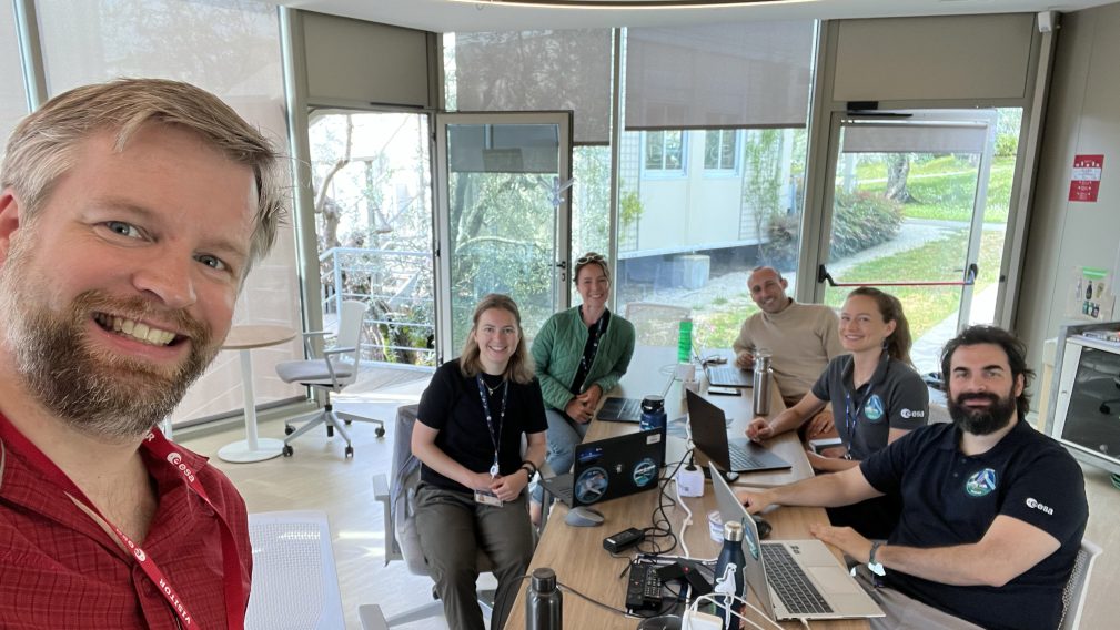
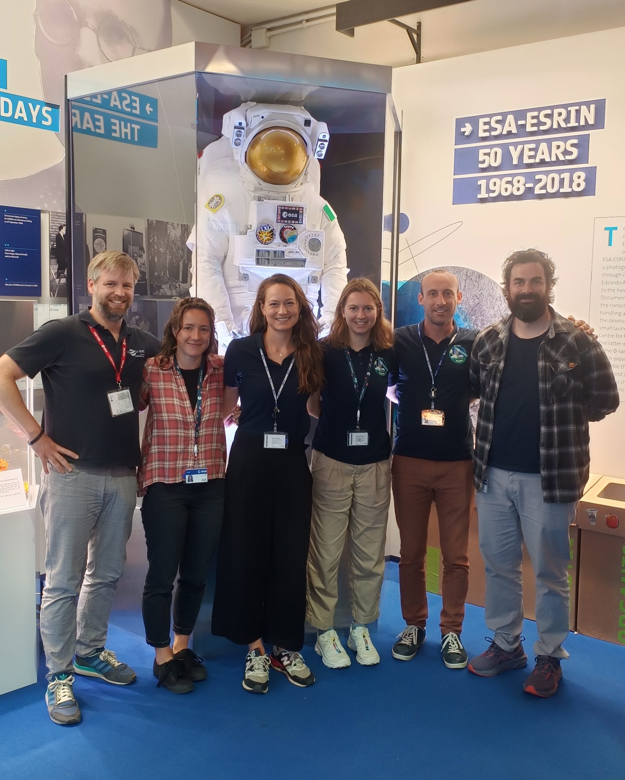
Featured image : The ESA team: Karsten Peters-von Gehlen, Saskia Brose, Blanka Piskala, Arthur Avenas, Johanna Mayer, and Beniamino Abis (left to right).