The European Space Agency (ESA) is delighted to announce the reopening of the Sentinel-3A World Fire Atlas, now upscaled at global level, providing the latest data on fire occurrences since June 2016. Following a successful prototyping phase in summer 2019, during which it supported European civil protection agencies and firefighter forces, the Atlas is now accessible once again at https://s3wfa.esa.int/.
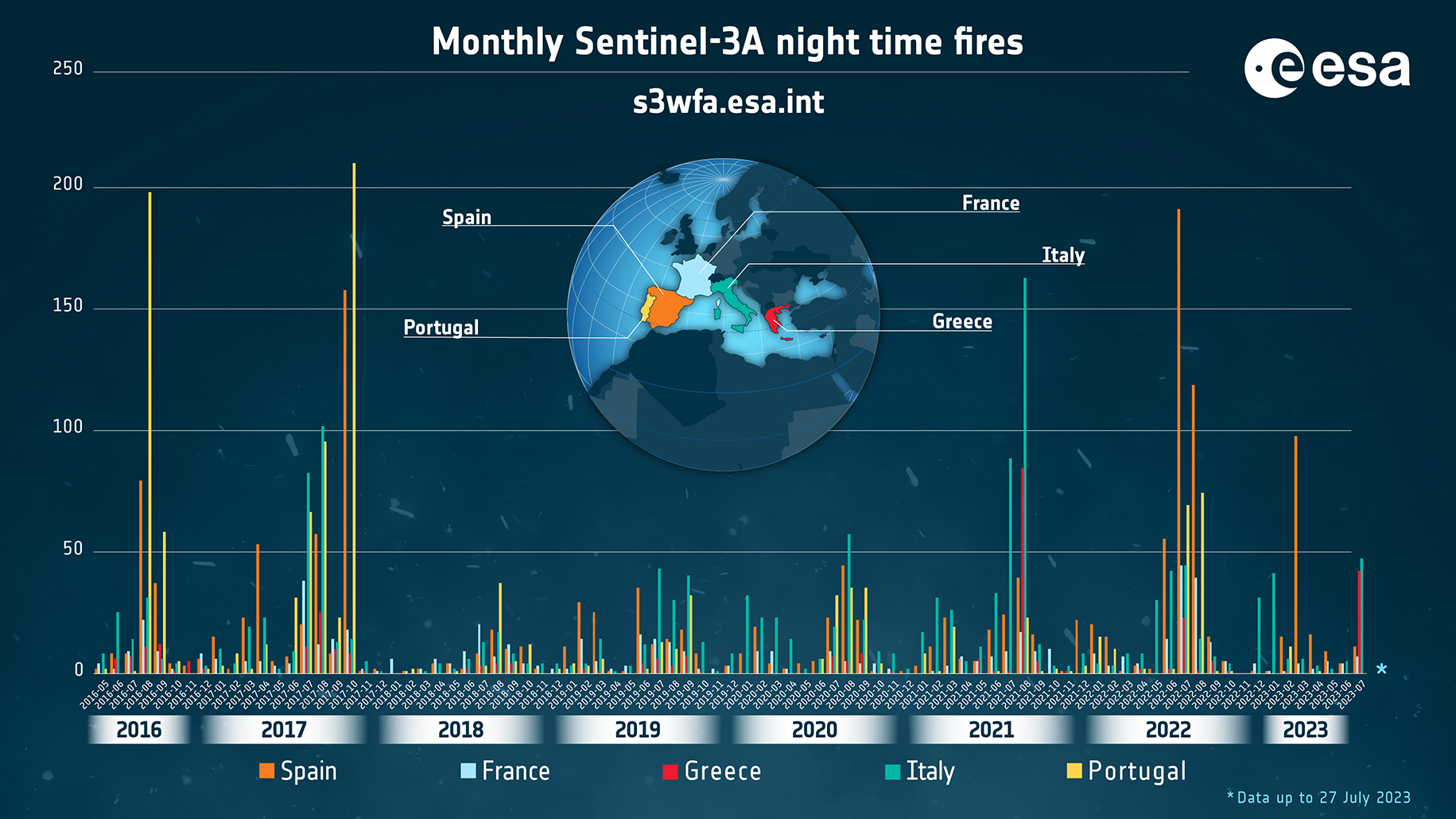
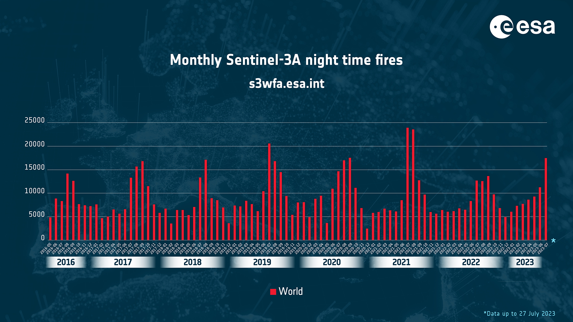
In light of the recurring severe heatwaves experienced worldwide, the Sentinel-3 World Fire Atlas offers updated statistical data on fire occurrence across the globe. It comprises two informative pages: the first offers insights into the worldwide distribution of single nighttime fires, detected at both country and global levels. Simultaneously, the second page features an interactive dashboard, allowing users to explore and analyze statistics in a user-friendly manner.
With the reopening of the Sentinel-3 World Fire Atlas, authorities, researchers, and organizations can continue to benefit from a comprehensive understanding of fire occurrence, aiding them in devising effective fire prevention and management strategies on a global scale. The Copernicus ESA and EU commitment to continuously providing this valuable resource reinforces the importance of leveraging space technology to address critical environmental challenges.
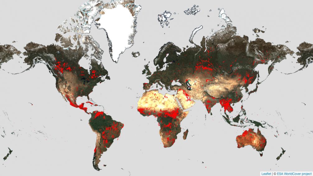
Featured image: Worldwide fires from the World Fire Atlas between May 2016 and June 2023.