Within two years, the Irrigation+ project consortium published 16 peer-reviewed scientific papers which leverage advanced Earth observation algorithms and techniques for irrigation mapping, quantification and detection.
An overview of main achievements – taking advantage of the exploitation of Copernicus Sentinel data – is provided in a webstory published today.
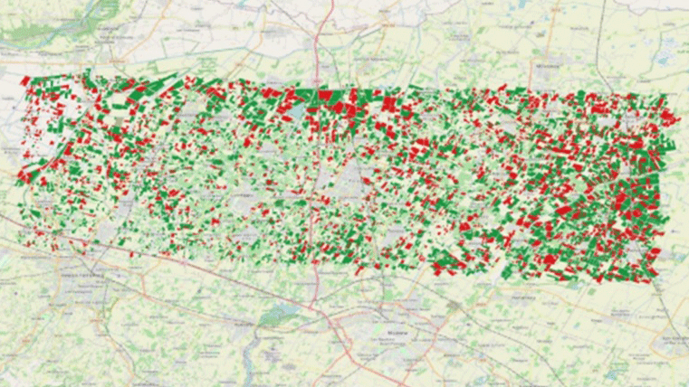
Featured image : Irrigation maps of a site in Urgell and the Emilia Romagna region, where green shows irrigated fields and red shows rainfed fields. The irrigation maps are based on the synergy of Copernicus Sentinel-1 and Sentinel-2 data. Contains modified Copernicus Sentinel data/ Elwan, E. et al