Disaster Risk Financing (DRF) represents an effective risk management option, able to complement more traditional Disaster Risk Reduction measures by offering a lean way to unlock resources for a fast and prompt reaction when a disaster occurs. This is particularly important when sovereign risk is considered in countries where the magnitude of flood events often overcomes the response capacity of the institutions. A typical example is South East Asia where extensive monsoon flooding often endures for months and hits large geographical areas.
In this context, EO product developments have provided enhanced detection capacity in support of such applications. This is the case with the services developed by the project e-Drift (Disaster RIsk Financing and Transfer), financed by the ESA EO Science for Society programme and led by CIMA Research Foundation (IT).
The project is framed in the cooperation between ESA and the World Bank/DRF Initiative that provided not only guidance for the service development, but also created the preconditions for its operational use in the context of SEADRIF: a regional platform that provides participating nations in South East Asia with advisory and financial services to increase preparedness, resilience and cooperation in response to climate and disaster risks.
Step 1: mapping the flood extent with e-Drift
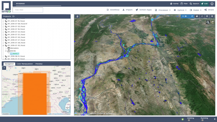
e-Drift created a processing environment that enables access to seamless EO added value services in support of DRF applications.
In particular, the platform allows the continuous monitoring of an extended Region of Interest (e.g. a full country) taking advantage of the S1 constellation global acquisition capability and of the free and long-term access to data guaranteed by the EU Copernicus services. A flood delineation map can be updated every day with any acquisition that crosses the region of interest, guaranteeing the best possible coverage. The process is fully automated and guarantees a high rate of data fetching.

Thanks to its reliability and high degree of automation the service does not require supervised intervention. Therefore, the same service can also be used to create an exhaustive set of past flood events on the analyzed area by processing the full archive of acquired satellite images. Such product can be translated into historical flood frequency maps that are used to calibrate catastrophe models in support of insurance applications.
Step 2: estimating the number of affected people with SEADRIF, to activate a parametric insurance
A first application that has been tested is parametric insurance to unlock resources for immediate and effective response in the aftermath of a flood event.
The e-Drift services feed into a platform created within the project South East Asia Flood Monitoring and Risk Assessment for Regional DRF Mechanism (SEADRIF) led by Deltares (NL), company leader in the hydrological modeling applications, in partnership with CIMA Research Foundation (IT), FadeOut SW (IT) and LIST (LU). This project was financed by the World Bank who also acted as a user of the e-Drift services in the context of SEADRIF.
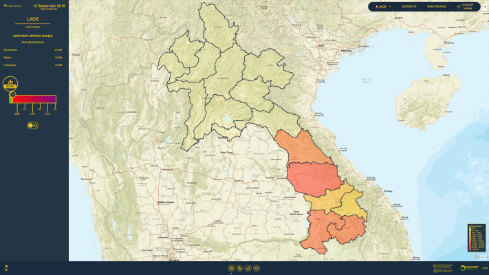
The SEADRIF platform combines the EO services provided by e-Drift with flood models in order to determine the number of affected people at country level for several countries in South East Asia. This output can be used to activate a parametric insurance in support of the countries for response operations.

Service demonstrations during the 2019 and 2020 monsoon seasons
After the service development and the establishment of a direct connection with the SEADRIF Client Platform, a pre-operational demonstration was set up for the 2019 monsoon season to better refine the operational setup and assess the e-Drift service reliability in contributing to the SEADRIF application.
On that basis three chains were set up: one over Myanmar, automated with daily supervision from an operator at CIMA Research Foundation, one over Cambodia and one over Lao PDR, fully automated and without supervision.
The demonstrations started in June 2019 and ended in September 2019, covering the whole monsoon season 2019. The demonstration assessment protocol was discussed with ESA and agreed with the World Bank, which closely assessed the service performance. Specifically, the World Bank has commissioned an application expert to follow the assessment of the Service Output.
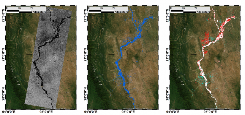
The results were validated both from the operational point of view – by assessing reliability of the production chain – and content standpoint (e.g. through comparison with alternative data sources from either EO or media). An example is shown in next figure, where results from the S1 chain are compared with Radarsat-2 acquired over the same area during the 2019 monsoon season.

During the demonstration phase a persistent flood event occurred in Myanmar, mainly along the Irrawaddy river, one of the main river systems in the country. As a result, close to hundred thousand of people were displaced and many more were affected by the flood event. The Platform detected the event and determined consistent estimates of the affected people during the entire period, monitoring its daily evolution. The system operated with over 98% of reliability in terms of timely processed imagery and result delivery checked on a daily basis, and 100% considering a 24 hours recovery window.

A second pre-operation phase in the monsoon season 2020 was also implemented with equally satisfactory results in terms of accuracy and reliability.
Transfer to operations
This successful demonstration paved the way for the operational implementation of the service.
JBA Consulting, a leading company in insurance applications, together with CIMA and the other e-Drift key partners have been awarded the provision of an operational service that will support the payouts in the SEA countries that adhered to the insurance scheme, triggered by clear and transparent rules. This service is delivered through an independent insurance company set up in Singapore to implement a regional catastrophe risk pool.
The parametric insurance for flood risks is based on the SEADRIF Flood Risk Monitoring Tool, which was the final object of the above-described demonstration.
The SEADRIF Flood Risk Monitoring service entered in operation in February 2021. The EO component of the service is provided by the e-Drift and the EO flood mapping service is the first operational service on the market from the e-Drift service portfolio.
The operations are envisaged to run for the next two monsoon seasons.
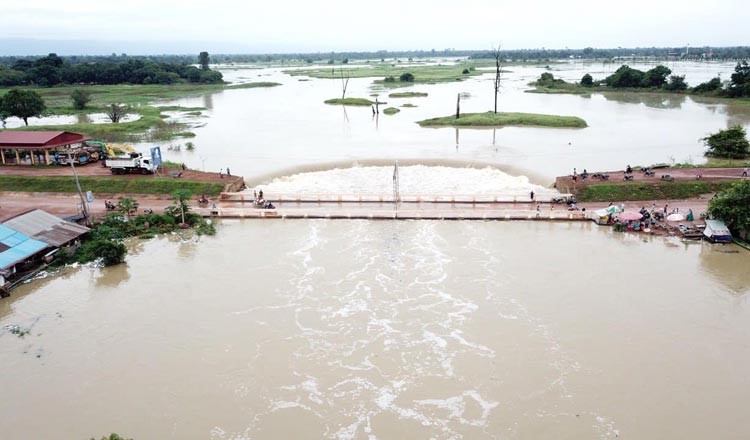
Featured image : Mekong River close to flooding during the 2019 monsoon season in Cambodia, September 2019. Credit: Cambodia MOWR

