A novel product suite on sea level across the Baltic Sea region, derived from altimetry measurements through the Baltic SEAL Regional Initiative project, is now available to download. A duo of products containing Sea Surface Height (SSH) information are provided, accompanied by a number of ancillary products.
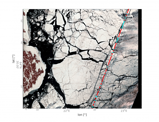
The first main product consists of along-track datasets of SSH estimates. Each dataset is from a single path of an altimeter over the Baltic Sea region. Mission data spanning from May 1995 to May 2019 were reprocessed using the latest advances in coastal altimetry, with over 45,000 enhanced SSH along-track datasets now available for the Baltic, up to and including data from Sentinel-3B. Furthermore, the project delivered advances in classification and signal processing of sea-ice covered areas, exploiting the sea level signal received from cracks and leads (see figure below). Therefore, this along-track dataset enables the retrieval of meaningful sea-level information closer to the coast, and much deeper into sea-ice prone areas, and expands our ability to monitor sea-level into higher latitudes.
The second main product consists of multi-sensor gridded SSH data products, covering the Baltic Sea region at monthly temporal resolution. These have been produced using data from all missions in the along-track suite of datasets. A multi-mission cross-calibration activity was essential here, aligning all along-track measurements with the TOPEX-Poseidon mission, and allowing a 24-year archive of gridded sea-level information to be generated for the Baltic Sea region.
In addition to the along-track and gridded products, two further added-value products are available – a new mean sea surface dataset for the Baltic Sea, as well as a sea level trend and annual cycle dataset, both of which are freely available to download with the main products.
To support data use, and the next generation of altimetry innovators, a comprehensive product handbook is provided with the dataset. Tailored specifically with fundamental information for altimetry novices, the handbook also contains detailed data specifications for the more expert user. There are also freely downloadable Python codes available, to help programming novices open, and explore their new datasets. Meanwhile educators can avail of the dedicated conversion codes, to convert files into more student-friendly image and vector formats used for teaching geo-spatial and Earth systems sciences.
Product download and documentation is available via the Baltic SEAL website. This includes the requirements analysis, validation reports, algorithm theoretical basis documents, and impact assessment reports. The scientific roadmap is also made available, charting a course forward for the various scientific advances made by the Baltic SEAL team.
These developments were produced by a multi-disciplinary team spanning four countries – the Technical University of Munich (DE), the Technical University of Denmark’s Space Institute (DK), the Finnish Meteorological Institute (FI), the Danish Meteorological Institute (DK), and University College Cork (IE). This collaboration was overseen, and supported by ESA under the Baltic+ element of the European Space Agency’s Earth Observation Envelope Programme 5 (EOEP5) Baltic Regional Initiative. It arose in direct response to major discussion points gathered during the Baltic from Space Workshop hosted by FMI in Helsinki in March, 2017.
The Product Handbook describing the dataset is:
Passaro, M., Müller, F., Dettmering, D., Abulaitjiang, A., Rautiainen, L., Scarrott, R.G., Chalençon, E., Sweeney, M., (2021). Baltic SEAL: Product Handbook, Version 1.1. Report delivered under the Baltic SEAL project (ESA contract no. 000126590/19/I/BG). DOI: http://doi.org/10.5270/esa.BalticSEAL.PH1.1
An article has been submitted to Frontiers in Marine Science:
Passaro M., Müller F.L., Oelsmann J., Rautiainen L., Dettmering D., Hart-Davis M.G., Abulaitijiang A., Andersen O.B., Høyer J.L., Madsen K.S., Ringgaard I.M., Särkkä J., Scarrott R., Schwatke S., Seitz F., Tuomi L., Restano M., Benveniste J.: Absolute Baltic Sea Level Trends in the Satellite Altimetry Era: A Revisit, Frontiers in Marine Science, under review.
The content of the project will be presented at the next workshop of the Inter-Commission Committee on “Geodesy for Climate Research” (ICCC, https://iccc.iag-aig.org/)
For further information, go to http://www.balticseal.eu, or contact info@balticseal.eu
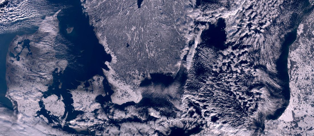
Featured image : Baltic Sea from Sentinel-3 OLCI, February 2021. Contains modified Copernicus Sentinel data (2021)