Decision-makers, planners and scientists can easily find in the Urban Thematic Exploitation Platform (U-TEP) resources, including multi-source data and visualisation/analytics tools, that help them creating and maintaining sustainable urban environments in major cities but also in smaller, rural areas.
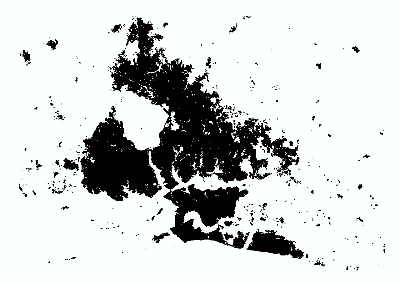
One of the recent add-ons to the rich database is the World Settlement Footprint 2015 (WSF-2015), the first map, using mass collections of radar and optical satellite imagery, to provide a global overview of the world’s human settlements. Later this year, this map will be paired by an extended version, the WSF-Evolution, using six million satellite images from 1985 to 2015 to analyse worldwide growth of human settlement on a year-by-year basis.
A set of monthly webinars is starting next 24 June to explain how to exploit the U-TEP tool and all its functions.
24 June 2019 – 5 PM to 5:30 PM CEST
Portal: Building the community and working in the community
Explore World Settlements Footprint 2015
Join via Google Meet: meet.google.com/uno-zsui-rdm
22 July 2019 – 3 PM to 3:30 PM CEST
VISAT: Integrate new data, in existing scopes as well as by the creation of new scopes
Bring your own data: we will integrate some of the data on the fly showing the whole process
Join via Google Meet: meet.google.com/eog-znoj-kun
19 August 2019 – 3 PM to 3:30 PM CEST
Usage of the EO Browser and of the publicly available processors
Join via Google Meet: meet.google.com/ymv-ctkk-vty
16 September 2019 – 3 PM to 3:30 PM CEST
Development Environment
Integrate your own new data processor showing on the example of the integration of the Urban Heat Island processor docker integration
Join via Google Meet: meet.google.com/kkj-tfgd-hjf
While waiting for forthcoming webinars, have a look at the recording of the past one.
Featured image : WSF-2015 built-up areas in Abidjan, Ivory Coast. The animation overlays the WSF-2015 product, derived from Copernicus Sentinel-1 data and US Landsat 8, with WSF-2015 Density, using Landsat 8 images, which indicated the level of imperviousness. The prototypic WSF-Density 2015 provides information regarding the percentage of sealed surface or greenness derives from temporal statistics such as the Normalized Difference Vegetation Index (NDVI). It is calculated globally for all areas assigned as built-up by the WSF-2015 layer. The WSF-2015 has been developed within the SAR4URBAN project. Copyright: DLR